Mapping Tech
Power Utilities Embrace GIS and Drones for Maintenance
EDM International’s tool identifies wildfire risks for utility clients.
At Esri’s Infrastructure Management and GIS conference, held in Palm Springs, Calif., Oct. 28-30, large utilities such as PG&E showed off how they were using geographic information systems when working with contractors and design firms as consultants to help them manage maintenance and asset needs.
Consultant EDM International has worked for utilities like Power New Mexico on initiatives such as how to better predict and prevent damage from wildfires.
“You first have to identify where the fire risk is on your landscape,” says Greg Brenton, UAS coordinator and pilot for EDM. “Then [you can]identify where your feeders intersect with those wildfire risk locations. We use the H3 spatial indexing system developed by Uber to compile wildfire risk model output data in a way that makes sense.”
Within the EDM system, each grid cell has a risk score based on those weighted values of wildfire output data. Risk factors could be anything ranging from damaged poles to foliage overgrowing a transmission station. After EDM assigns overall risk scores to each cell, it can visualize those areas on a GIS map.
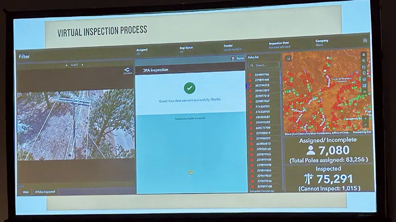
Power Engineers, a subsidiary of WSP, developed a GIS platform and digital twin to automate and streamline how it collected construction field data, managed site inspections, and generated construction reports and approvals for a utility managing assets from the Canadian border to New York City.
Looking for quick answers on construction and engineering topics?
Try Ask ENR, our new smart AI search tool.
Ask ENR →


