Home » Keywords: » GIS
Items Tagged with 'GIS'
ARTICLES
BIM
Cesium has deal with Google to create 3D Tiles for Google Earth
Read More
BIM
Esri, Autodesk Deepen Data Connections With CAD, Revit Features Coming to ArcGIS Pro
GIS mapping giant and AEC software powerhouse continue to bring disparate systems closer together
Read More
Technology First Read
Building More with Less Waste, How GIS Helps Construction Go Full Circle
Read MoreConstruction Technology
Procore Launches Payment Service, Expands Offerings at Groundbreak
Tech provider formally launches its Pay service, announces acquisition of GIS platform
Read More
Technology First Read
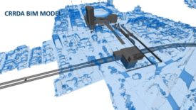
Brisbane's Cross-River Rail Project Uses BIM, GIS and a Gaming Engine
Aussies get recommendations from Brits on transit project that takes a tech village
Read More
Technology First Read
Digital Twins Help Infrastructure Become Smarter
A digital twin for major infrastructure is only as good as the data that informs it
Read More
Geo Week Events Call for Action on Climate, Workflow, Diversity in Geotechnical Disciplines
Esri’s Jack Dangermond spotlights GIS interconnectivity, urges industrywide collaboration for ‘mapping common ground’
The latest news and information
#1 Source for Construction News, Data, Rankings, Analysis, and Commentary
JOIN ENR UNLIMITEDCopyright ©2025. All Rights Reserved BNP Media.
Design, CMS, Hosting & Web Development :: ePublishing


_ENRready.jpg?height=168&t=1721243084&width=275)


