Best of the Best
Project of the Year Finalist, Best Residential/Hospitality: Clippership Wharf

Clippership Wharf protects East Boston residences from flooding and predicted sea level rise.
Photo courtesy of Lendlease
Clippership Wharf | Submitted by Lendlease (US) Construction LMB Inc.
East Boston
Region: ENR New England
Residential/Hospitality
DEVELOPER: Lendlease Development
GENERAL CONTRACTOR: Lendlease (US) Construction LMB Inc.
LEAD DESIGN FIRM: The Architectural Team
ENGINEERS: Cates Engineering (Structural); Nitsch Engineering (Civil); WSP USA (MEP)
LANDSCAPE DESIGNER: Halvorson | Tighe & Bond Studio
SUBCONTRACTORS: Sunrise Erectors (Facade); S&F Concrete; AA Will (Foundations); East Coast Interiors (Wood Structure); Jantile (Stone and Tile)
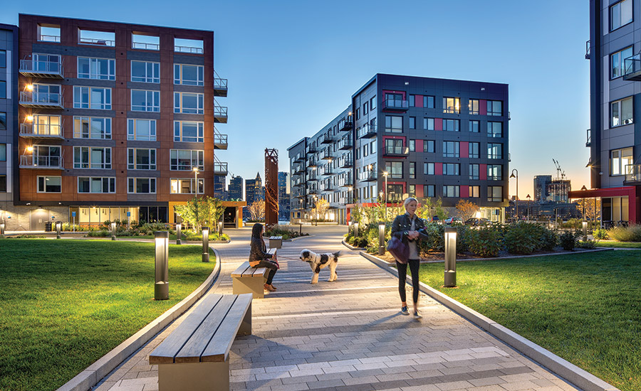
After three decades lying vacant, a 14-acre former industrial site along the harbor in East Boston is not only home to a vibrant mixed-use community, it’s setting new standards for resilient and sustainable development. Completed in March 2021, Clippership Wharf features a mix of four residential buildings with 478 residential units on the upper floors and a mix of residential, retail, public and recreational spaces on the main level. What makes the development unique is its response to future sea-level rise, setting residential entrances at 14 ft above mean high tide, well above FEMA guidelines. The project also broke norms along the harbor by creating an intertidal area that allows the tides to move in and out of the site naturally, rather than holding them back with seawalls. Nick Iselin, general manager for Boston development at LendLease, says the strategy helped solve two main issues: concerns about future sea-level rise and the expense of excavating portions of the site, which would require removal and proper disposal of contaminated soils. “The incentives were aligned,” he says. “The resilient solution suggested we raise the site as high as we could. The remediation goal of having less exposure to contaminated soils also suggested that we raise the site. Those two aims were not conflicting and helped push us to the right solution.”
Clippership Wharf, which won ENR New England’s Project of the Year, is not only built to be resilient against future sea level rise, the project on East Boston’s waterfront also transformed an underutilized area.
Photos courtesy of Lendlease
Iselin says that although the strategy seems obvious now, its initial efforts to gain city approvals were challenging, as project planning predated the Climate Ready Boston initiative. “There was not really a roadmap for the solutions we were targeting,” he says. “The regulatory framework is complex. We just had to be patient and not succumb to the pressure to fold our tent when things weren’t lining up perfectly.”
The design envisioned a development that set a 300-space garage at 14 ft from Boston City Base (BCB) level with minimal excavation into the sloping shoreline. At its farthest point inland, the garage is 17 ft above BCB. For its foundation, the garage—which also serves as a podium for the development’s residential buildings—uses roughly 120,000 sq ft of slab-on-grade with 1,200 concrete piles driven to depths ranging from 70 ft to 120 ft.
Clippership Wharf, which won ENR New England’s Project of the Year, is not only built to be resilient against future sea level rise, the project on East Boston’s waterfront also transformed an underutilized area.
Photos courtesy of Lendlease
Greg McGee, principal in charge and vice president at LendLease, says the slabs in the garage also articulate, where possible, to further reduce the need to excavate soils. “It was a complicated process and very different than what most people would even consider doing,” he says. “But taking out just another 100 yards of soil would have been a substantial financial decision.”
Clippership Wharf, which won ENR New England’s Project of the Year, is not only built to be resilient against future sea level rise, the project on East Boston’s waterfront also transformed an underutilized area.
Photos courtesy of Lendlease
The site features 1,700 linear ft of harbor front, including an intertidal zone that serves as a living shoreline. While neighboring developments use seawalls, the intertidal portion of the site instead uses a series of salt marsh terraces that bracket daily tides. At high tide, water is approximately 12 ft from the edge of building structures, while low tide can take the water out to about 180 ft from the development. The zone transitions from salt marsh grasses to a “coastal field” with plantings such as red fescue, butterfly weed and switch grasses. “It’s the first time in modern city history that a project on the harbor has created an intertidal zone with the pure intention of celebrating the tidal fluctuations with the plant communities and the wildlife habitat that it brings,” says Rob Adams, principal landscape architect at Halvorson Design.
McGee says crews that installed the marsh plantings often had to schedule shifts around the tides, since tides in the harbor can fluctuate by 10 ft in elevation.
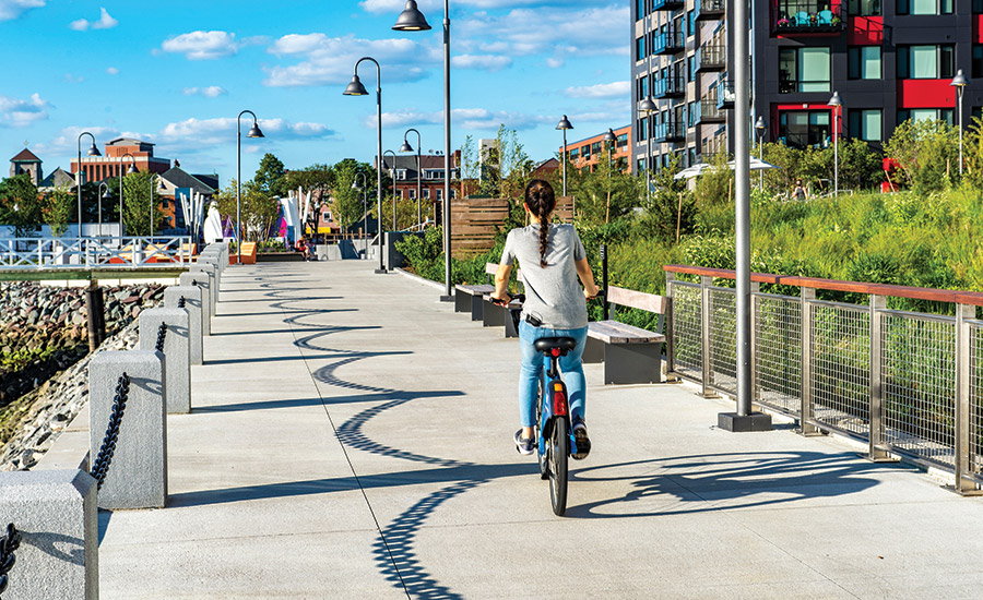
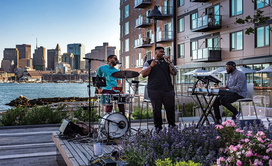
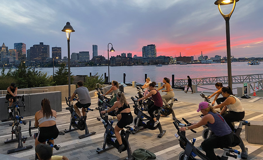
The project also accommodates a new section of the 43-mile Boston Harborwalk, which connects neighborhoods along the harbor. From the Harborwalk, the community can access the site’s public amenities, including a large amphitheater, a dog park and two onsite docks used for kayaking, water taxis or public docking.
Looking for quick answers on construction and engineering topics?
Try Ask ENR, our new smart AI search tool.
Ask ENR →
Clippership Wharf, which won ENR New England’s Project of the Year, is not only built to be resilient against future sea level rise, the project on East Boston’s waterfront also transformed an underutilized area.
Photos courtesy of Lendlease
Andrew Stebbins, senior project manager with the Architectural Team, the lead design firm, says public space was a major consideration. The city requires portions of the waterfront to be publicly accessible. He says the city was initially concerned that the raised site might appear to block access. “The city had never seen a project try to provide public space on an elevated platform,” he adds.
Stebbins says the design included ramps and berms that flowed from existing neighborhood walkways to elevated portions of the site, as a way to improve public access. Openings were designed through the buildings to provide visibility of the harbor from the street. He adds that Clippership’s elevated public spaces provide improved visibility of the harbor, the city skyline and sunsets. “Things that were once perceived as roadblocks became opportunities on this project,” he says.
-Construction-LMB-Inc.webp?height=200&t=1638456100&width=200 "Clippership Wharf")

