When completed in 2025, the new paved road will reach a hydroelectric plant just a few miles from the Machu Picchu sanctuary. Travelers can either continue on foot or by train to the town Aguas Calientes near the historic site.
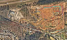
Contractor Brasfield & Gorrie is working to update its site maps to avoid utility strikes and other incidents by integrating drone flight data directly into their GIS maps using Esri’s Site Scan for ArcGIS Pro.
Billable hours have long been the professional services standard by which architects, engineers, lawyers and accountants all get paid. But what if that effort wasn’t from human toil at all?
With AI-driven modeling, flood projections and scenario plans can be set
up quickly, allowing far more sensitivity and insight than a static
projection can generate from historical data.
From diverse technical, business and skilled trade backgrounds, ENR’s 2024 National Top 20 under 40 winners have emerged as leaders at their respective organizations.
Fueled by employee ownership, a strategic vision and expansive service offerings, Terracon is helping grow the Midwest, thousands of projects at a time.
 RSS
RSS