In today’s world of readily available aerial imagery from satellites and drones, the future of high-resolution aerial imagery taken from manned, fixed-wing aircraft might be questioned, but consumers of all three types of images say there is still a big role for manned-aircraft imaging services.
Researchers from NASA’s Jet Propulsion Lab and the University of California, Merced, are testing a drone-mounted methane-detection device that sports a miniaturized version of the NASA Mars Curiosity Rovers’ sensor array.
When reading the news it seems developers, architects, engineers and contractors are fascinated with using unmanned aircraft on their next big project. And legally, any of them can fly a drone for recreational purposes within his or her field of vision and at a height of no more than 400 feet above ground provided they are not in restricted areas like airports or government installations like the White House. But whenever they step into the commercial space, new rules apply; and to avoid large fines here’s some advice.
Beachwood, Ohio-based Tremco Roofing and Building Maintenance teamed up with Toronto-based Industrial SkyWorks, an unmanned aerial vehicle (UAV) and data solutions company that received the first-ever approval for nighttime flights in the U.S.—moving the construction industry to the forefront of the UAV field.
With no relief in sight from a Federal Aviation Administration requirement that all drone flights be overseen by licensed drone pilots, a San Francisco-based company that had been developing an autonomous aerial jobsite survey system is adjusting.
The Federal Aviation Administration on Nov. 3 convened a 26-person task force to develop ideas for a system to register unmanned aerial vehicles, or drones.
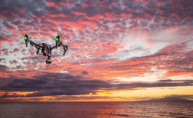
For decades now, the word “drones” has evoked a militaristic image of pilotless aircraft, but the technology of unmanned flight has evolved and adapted to meet civilian needs.