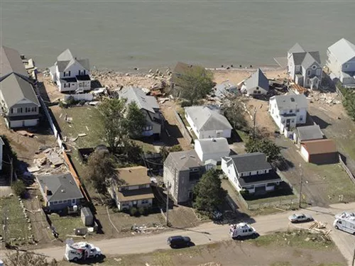
For a Downgraded Storm, Irene Leaves Her Mark on East Coast Infrastructure

Tim Dugan, spokesman for the Army Corps of Engineers, New England District, says the Corps had to use generators to support some of its projects," he says.
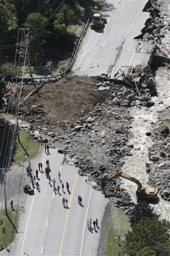
The New Hampshire Dept. of Transportation reports that 55 roads had closed at the peak of the storm, with six sections of state-maintained highway still affected. On U.S. 302 in Harts Location, the road was totally washed out and the bridge destroyed, a spokesman says. Four design teams were out yesterday to estimate the damage and plan for a temporary fix.
Maine DOT officials say much of the worst damage occurred in the northern Franklin and Oxford counties and expect damage estimates out by early September. At the storm's peak, nearly 200 roads were affected, as well as a dozen bridges, the state reports. John Buxton, state bridge maintenance engineer for Maine DOT, says two bridges on Route 27 in Carabasset Valley in northwestern Maine were washed out.
MaineDOT reports that it is working with the governor's office and Federal Highway Administration officials to expedite repair and replacement due to the importance of Route 27 to the regional economy. The cost for the emergency work will be entirely or mostly federally funded, he says.
Kazem Farhoumaand, chief engineer at Rhode Island DOT, says the state is still assessing damage, and no estimate on cost of repair is available. Kevin Nursick, spokesman for the Connecticut Dept. of Transportation, says the agency had over 300 road closures statewide during the storm but sustained no infrastructure damage.
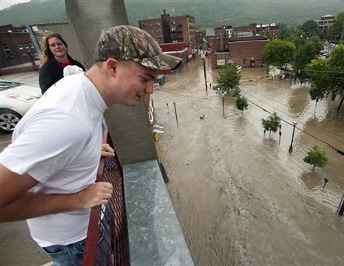
Water Everywhere, Except in the Tap
Flooding affected water and wastewater facilities and interrupted service to customers up and down the coast, although they fared better than expected, industry sources say.
Carolina Beach, N.C. officials reported a wastewater spill of at least 1,000 gallons due to rain and flooding. Tyrrell County's emergency management director, Wesley Hopkins, said the generator to keep the plant in Columbia operating was not working at ENR press time. Elsewhere in eastern North Carolina, untreated wastewater had gone directly into the Roanoke River.
But Patricia Lamb, preparedness manager for Charlotte-Mecklenburg utilities in Charlotte, N.C., says, "[Overall] we did not have as much physical damage as we had feared based on the predictions." The main impact has been loose debris and loss of power, Lamb says.
A network of utilities called the North Carolina Water and Wastewater Response Network (NCWARN) has been active in helping utilities without power or who are dealing with flooding. As of Aug. 30, NCWARN had distributed seven generators to local facilities without power, Lamb says.
Kevin Morley, security and preparedness manager for the American Water Works Association, adds that water and wastewater response networks, which have been established in nearly all 50 states, allow utilities to respond quickly. "The whole objective is to expedite [the cleanup] as quickly as possible to get these systems operations back on their feet," he says.
Morley notes flood impacts, particularly in Connecticut, New York, New Jersey and Vermont. However, where the water has not yet receded, it is too soon to tell whether there has been any structural damage to power plants, he says.
"Because of the volume and speed of the water, portions of plants could be undermined and the distribution networks could be compromised," he says.
In New Jersey, flooding knocked out power to water treatment plants in Millburn and Bridgewater, operated by investor-owned utility New Jersey American Water Corp. As a result, the utility sent out "boil your water" edicts for close to 300,000 customers.
On Aug. 29, spokesman Richard G. Barnes said, "We're working to have power restored at our facilities and for floodwaters to recede. While we work through these challenges, we don't have an estimate as to when normal service will be restored."
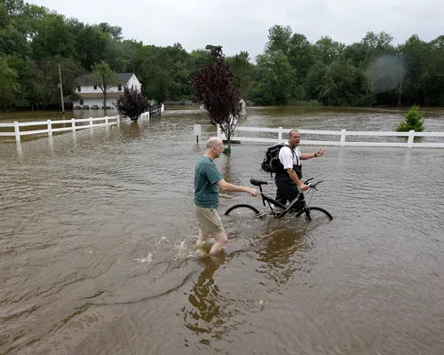
The trouble isn't over yet. And Irene's effects around the middle Hudson and middle and lower Connecticut rivers were multiplied by grounds that had recently been soaked by heavy rains.
NOAA's Vallee says that rivers in those areas had yet to crest as of Aug. 29. He adds that conditions were worsened by a thunderstorm that hit the region a week or 10 days before Irene struck, producing stream flows much higher than normal.
"That antecedent condition is really the catalyst for these remarkable floods that we've experienced," Vallee says.
By Pam Radtke Russell, Debra K. Rubin, Aileen Cho, Tom Ichniowski, Johanna Knapschaefer and Pam Hunter. Nadine M. Post, Lisa Wood, Mary B. Powers and Jim Parsons contributed to this story.


