Technology has become firmly embedded in disaster response and management, and every major event, such as the record-demolishing September 2018 floods in the Carolinas, sees new or improved tools showing up in the toolbox.
In addition to drones, which are heavily engaged in the ongoing emergency response, flood prediction, modeling and tracking tools are being pressed into service—and not only to suit the purposes for which they were designed.
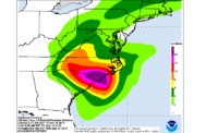
Refugees trying to navigate the roadways through the shifting floods that covered huge areas of both states reported that they had discovered that while Google Maps showed many flooded roads as unobstructed by stalled traffic (because there were no cars to be found), the N.C. Flood Inundation Mapping and Alert Network was considerably more useful for finding open routes. Its homepage map interface not only shows live river gauge readings rated for their current flood stage in North Carolina, but also a composite live radar image. The indicator can be zoomed out to cover both states and show the heavy rain bands of the storm. Drilling in on any gauge reveals an aerial photo of the surrounding area with modeling of inundation to be expected at that place at any given stage.
The state of South Carolina and the U.S. Army Corps of Engineers also modeled flooding, using ArcMap, from ArcGIS and recent LiDAR data to develop inundation maps for different river stages.
The Corps used the tool to identify a strategic location in an area threatened by rising waters of the Waccamaw River to build parallel, 8,100-ft-long emergency floodwalls to keep U.S. 501 between Conway and Myrtle Beach open for emergency vehicles. The river is expected to crest on Sept. 26.


Post a comment to this article
Report Abusive Comment