BP Oil Well Blowout Eroded Gulf Coast

Figure 1. Northeastern Barataria Bay, Louisiana, USA, showing shores oiled during May-July 2010. Map of the study area showing the shoreline oiling severity categories from the Shoreline Cleanup Assessment Techniques (SCAT) map, documenting cumulative oiling from the Deepwater Horizon spill [SCAT, 2014]. The base map shows the land/water classification derived from radar. Locations of Coastwide Reference Monitoring System (CRMS) hydrology stations are indicated. The inset on the left shows the study region and the inset on the right locates the study area on a Landsat image.

Figure 2. Changing shoreline locations from June 2009 to October 2012 showing land loss and island fragmentation following petroleum oiling and cyclonic storm. Shown are oiled shorelines that exhibited (a) high loss in Year 1 post-spill, decreased loss in Year 2, and little loss following Hurricane Isaac; (b) high loss both Year 1 and Year 2 post-spill and little loss following Hurricane Isaac; (c) small island exposed to both heavy oiling and intense waves showing high rates of loss throughout the study period that intensified during Hurricane Isaac high loss leading to small island fragmentation (Note the scale difference for panel c).
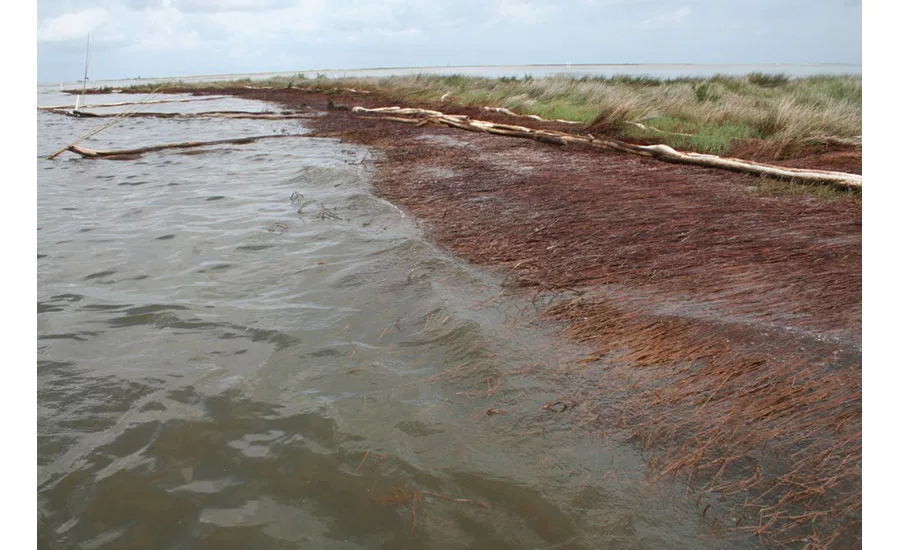
Photo by Bruce A. Davis
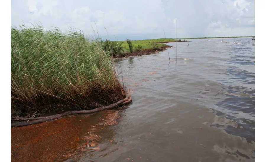
Photo by Bruce A. Davis
The 2010 BP Deepwater Horizon oil-well blowout caused dramatic, widespread shoreline loss along Louisiana’s coast, says a new study by the U.S. Geological Survey and the National Aeronautics and Space Administration. The study revealed that oil-coated wetland margins in Barataria Bay, the site of the heaviest Deepwater Horizon contamination, suffered greater land loss than the bay’s non-oiled shorelines exposed to just normal wave action.
A hurricane that struck about six months after the study was completed provided further measurement of the damage caused by oiling: The oiled shorelines suffered much greater loss than marshes that had not been oiled. “There was broadly dispersed erosion due to oiling from the Deepwater Horizon spill and more severe, but localized, erosion from Hurricane Isaac,” said Amina Rangoonwala, USGS geophysicist and lead author of the study.
“The most startling thing was that the pattern of shoreline loss changed dramatically,” says Cathleen Jones, a NASA member of the research team. In a normal year, areas exposed to incoming waves erode the most, she says. But the oil had coated all the shores and all the shorelines were eroded, not just the shores exposed to waves, she notes.
Oiled marshland is vulnerable because the marsh vegetation’s roots stabilize the soil. “Damage from petroleum was visible on the aboveground portion of the plants, but there was also an unseen effect on the roots,” says Chuck Perrodin, spokesman for the Louisiana Coastal Protection and Restoration Authority. “The roots were reduced and weakened due to the stress placed on the plants by the oiling. The weakened plants were easily eroded by Hurricane Isaac.”
Looking for quick answers on construction and engineering topics?
Try Ask ENR, our new smart AI search tool.
Ask ENR →