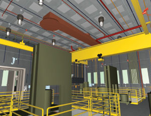
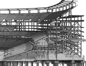
A common misperception about BIM is that it�s just for designing and constructing buildings. �People shouldn�t look at the word �building� in BIM as an actual building, but as the verb �to build,�� says Jay Mezher, design visualization manager for Parsons Brinckerhoff in Seattle. �It�s not limited to vertical structures. You can model and analyze as many issues in horizontal projects as you can in buildings.�


An increasing number of engineers and builders in the industrial, infrastructure and civil disciplines are finding valuable applications for model-enabled processes on nonbuilding projects, paving the way toward a range of new opportunities. This emerging area of practice is what we call “Heavy BIM.”
This Special Section on Heavy BIM explores how teams are employing a variety of virtual design and construction techniques to improve outcomes for community outreach, optimized planning, improved constructability, sustainability goals and simulated operations of complex projects.
Civil BIM
Research for the recently published McGraw-Hill Construction SmartMarket Report entitled “The Business Value of BIM” shows that civil engineers lag behind other engineering disciplines in their adoption of BIM. More than 80% of civil engineers are still not using BIM today. However, those who are using it are forecasting dramatic increase in usage.
Today, only 10% of the civil engineers who are utilizing BIM can be characterized as what we call “very heavy users,” meaning they are using it on more than 60% of their projects. But when all the civil engineers now using BIM were asked to predict their level of usage in two years, 40% said they will be at the very heavy user level within that time frame.
PB began using virtual design and construction at the Alaskan Way Viaduct and Seawall Replacement project in Seattle in 2004 and has seen its application evolve over time. The project aims to replace the existing Alaskan Way Viaduct, a critical elevated highway that was damaged by an earthquake in 2001.
Initially, PB’s efforts were focused on project visualization for public outreach. The team modeled two options—an elevated structure and a tunnel—creating a five-minute video that would allow the public to visualize driving through the proposed alignments. In addition to modeling the structures themselves, the surrounding existing buildings were created in 3D. To improve the sense of virtual reality, cars, trees and people were added to the animations.
In addition to traffic simulations, the models also played a critical role in supporting environmental impact studies, showing pedestrian views of the project. The team blended actual photos with the 3D model to create a more realistic sense of place.
“We were beginning to build the entire city in 3D,” Mezher says. “Since it’s an urban-scale project, we had GIS data that we could use; we had the footprints of the buildings; and we had the building heights. It was all a very accurate representation.”
As the database of project-related information began to grow, other tasks emerged. To help show the potential impact on the local community, PB created visual simulations of construction phasing.
Data from multiple traffic studies was added to the model so viewers could accurately visualize the impact that construction might have on traffic. An interactive Web tool was created to help show traffic during each construction phase and at different times of the day.
Although the two original alignments were rejected, the database was available for use on 10 new options that were created. Among the alternatives was a deep-bore tunnel that required modelers to add in all of the basements of surrounding buildings as well as existing railroad, sewer and utility tunnels. At this point, the team’s modeling tasks began to transition from a tool to help with public presentations to one that could guide design decisions.

Post a comment to this article
Report Abusive Comment