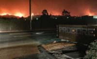
A Laguna Beach, Calif.-based engineering company is testing the ground in historically unstable Bluebird Canyon before the city determines whether owners of 18 multimillion-dollar residences destroyed in a June 1 landslide will be allowed to rebuild. Evacuated residents of 22 homes in the tenuous "warm" zone will also find out if they are allowed to go back to their homes.
 |
| Map of slide zone shows large weak zones in red (1), which led to slide (2). Another nearby area (3) is vulnerable. (Map courtesy of Goeka Geomorphoplogic Research Center) |
"We cant say what will be allowed to be rebuilt or even whether the slope will be remediated," says Steve May, director of public works for the City of Laguna Beach.
While utility crews worked to restore damaged power, water and sewer services, lcrews from local engineering consultant Geofirm Inc. installed inclinometers to monitor movement, boring holes as much as 75 ft deep to measure the water table. Southern California had its second-rainiest season on record this year with nearly 28 inches of rain since last July, more than double the annual average, according to Federal Emergency Management Agency.
The map produced using Geofirm�s test results will help the city decide what can safely be rebuilt. Although the homes on that hill are a mix of old and new construction, reinforcement requirements would not have saved the structures, according to May. "The slide went down to the bedrock. No amount of foundation would have made a difference."
The danger isnt over yet, warns Senior Engineering Geologist Bill McCormick for San Diego-based Kleinfelder Inc. Many of the largest slides come not during a heavy rain, but in the spring or early summer when ground water seeps into unconsolidated silt deposits and makes the ground unstable. "It is a matter of balancing the driving force (the weight of the water in the ground) and the retaining force (the weight at the bottom of the hill)," McCormick explains. He dashed the theory suggested by some residents that the weight of any single home even a large one -- could make a difference in the stability of the hillside. "The weight of the water in the substrata is causing the unbalance," he says. McCormick suggests installing horizontal hydraugers to drain the water before it becomes a problem.
Additional Weak Zones are present in the neighboring areas, according to Peter Schniedermeier, managing director Geoka USA, a division of Trier, Germany-based Geoka Geomorphoplogic Research Center, which has produced a three-dimensional spatial inclination map they call a Ladwein Map of the area showing the specific parcels in danger. "There are additional weak zones at the top of the slope which could become distressed through strong precipitation," reads the map interpretation.
Terry Brandt, now retired assistant city manager for municipal services, recalls when the Southern California hillside gave way in October, 1978. "It is an ancient landslide area," says Brandt of the exclusive oceanfront property. The disaster 27 years ago, which destroyed two dozen homes, occurred when massive rains percolated through clay seams and lubricated the substrata, allowing the upper strata to move, according to Brandt. The city used a combination of local and FEMA funds to install surface and subsurface drainage, rebuild and recompact the hillside. When the area slipped again in 1998, 300 homes were damaged and FEMA funds were used to help purchase a home considered unsafe.
Steve May says Laguna Beach officials are "talking to the governor's office and the Office of Emergency Services about obtaining OES or FEMA money."
The amount needed has not yet determined. "There are some infrastructure needs, like roads and utilities, that will have to be restored whether the homes that were lost are rebuilt or not."
Homeowners in the slide zone cannot get landslide insurance. "They are in a real fix," May says.
Links: More maps fromGeoka

Post a comment to this article
Report Abusive Comment