Geodesign Combines Strengths of BIM and GIS in New Convergence Platforms

Building information modeling and geographic information systems should be natural partners. But they use different technology, standards and syntax, so users often find it difficult to exchange information between the two environments.
BIM combines performance, scheduling, acoustics and other parameters with physical geometry. GIS analyzes spatial relationships within the natural and built environments. It can also perform complex modeling for a wide range of simulations. Together, the two can be an information powerhouse for planners, designers, builders and owners—if the data can be exchanged or layered into a single model.
"One of the challenges of GIS utilization in construction and design has been the ability to integrate BIM data with GIS data in a usable way," says Eric Gilbey, landscape architecture specialist at Munich-based Nemetschek Vectorworks Inc., a BIM software developer. "Different stakeholders will need to be able to exchange files, regardless of what software they use."
While most BIM software can import GIS data and vice versa, there are limitations. The accuracy and intelligence of some data is lost when translated between platforms, Gilbey explains.
"What happens is that each BIM and GIS vendor will come up with their own solution for exchanging data, but oftentimes the exchange requires users to jump through multiple hoops," says John M. Przybyla, senior vice president at Woolpert, a design, geospatial and infrastructure management firm in Dayton, Ohio. “It’s an imperfect system. We’re trying to make the process smoother and more standardized, so this data can be retained and used for facility management for generations to come,” Przybyla adds.
He is past chair of the GIS/BIM Information Exchange Committee of the buildingSMARTalliance, part of the nonprofit National Institute of Building Sciences in Washington, D.C. The committee is developing an international open data standard for improved BIM and GIS interoperability.
“If you have consensus on an international level, vendors will develop the softwares to meet those standards,” says Dana Smith, executive director of the buildingSMART alliance. “Currently, they have to build softwares to meet the different standards in each country, which ultimately means they can’t devote as much time and money to product development. The fewer products vendors have to develop, the better products we will get as a community.”
Achieving an international standard could take up to five years. For now, most BIM vendors are making products that export models to the collaboration file format established by the Industry Foundation Classes. BuildingSmart created the format as an open standard for representing 3D buildings with data (known as International Standard ISO 16739).
Some GIS softwares, such as select products from Trimble and ESRI, have the ability to use interoperability data extensions to import IFC files. A number of countries—including the United States, Denmark, Finland, and Norway—currently require IFC formats for publicly funded building projects.
BIM advances allow users to more easily leverage GIS capabilities while new features in GIS software bolster design capabilities. The two technologies are inching toward a convergence, dubbed "geodesign." Vectorworks 2014, released in September, allows users to control GIS projections of documents onto a design layer. Autodesk InfraWorks 2014 adds more GIS utilization as well. This year, Trimble introduced Trimble Field Points software for field layout, and Redlands, Calif.-based ESRI continues to offer its CityEngine, which transforms 2D GIS data into smart 3D models.
More cloud-based GIS products are on the horizon, reducing the need for large servers and onsite storage, says Eric Wittner, 3D technology evangelist at ESRI. Low-cost, easy-to-learn geodesign options are overcoming traditional price-point and knowledge barriers for both BIM and GIS.
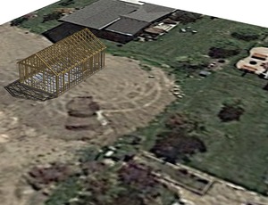
Trimble's SketchUp Pro, for example, is a practical alternative to more complicated, expensive CAD software. SketchUp can produce a 3D model using GIS information that helps plan site logistics and manage deliveries. The 3D app has spatial properties that upload terrain maps and images from Google Earth and place a SketchUp model there.
The renewable-energy group at Mortenson Construction, Minneapolis, relies on Google Earth to coordinate work for large wind-power projects.
"These projects often span hundreds of acres. We use it in our daily meetings to help the group visualize the project and where everyone is going to be working," says Sera Maloney, the group's senior integrated construction manager. "With a free version of Google Earth, we can get most everything we need to manage a project. It's cost effective. Most people know how to use Google maps. It's user intuitive."


