Construction History
Great Mississippi Flood of 1927 Shifted Responsibility to Feds
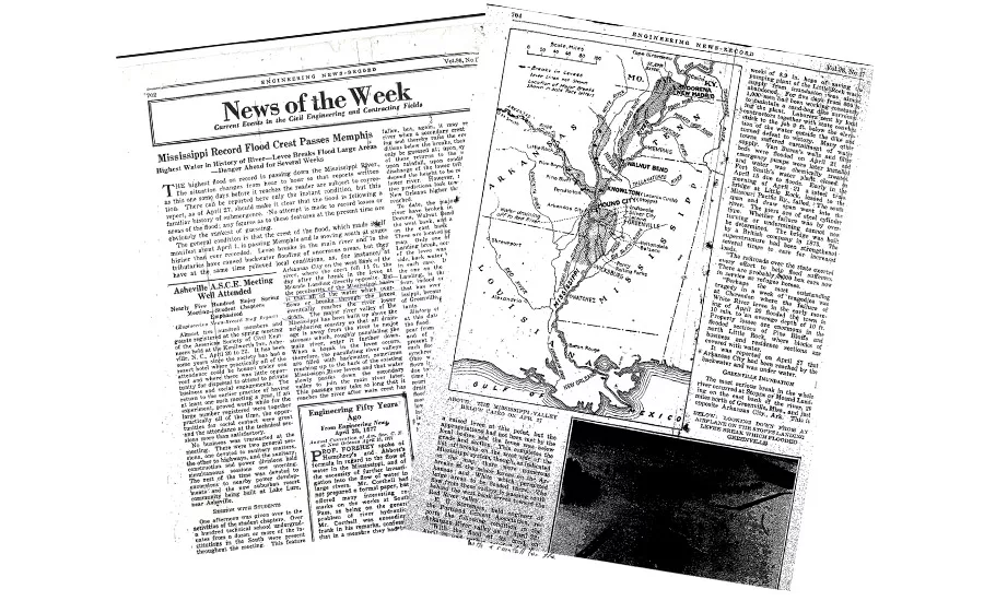
Image from ENR Archives

The article began, “As this is written, most ominous reports come from the Mississippi Valley.” This brief mention in the pages of ENR came as one of the greatest disasters in U.S. history was unfolding.
Unusually heavy rains in late 1926, as far north as Iowa, Kansas and Tennessee, continued that winter across the Mississippi River Valley. By Christmas in Nashville, the Cumberland River, a Mississippi tributary, neared its highest-ever level. By February, the White River in Arkansas, another tributary, was at flood stage.
The slowly developing threat was outlined: “The rains and melting snows of the entire Mississippi Valley, a third of the area of the continental United States, contribute to make the Mississippi River. When rainfalls so occur as to concentrate at the tributary mouths with melting snows from the north and the waters from the other swollen tributaries, we have floods. Expectation of record high water in the river has always been based on something short of the worst combination of these tributary floods, but today we have almost a record flow in the upper river meeting the lower rivers swollen by tremendous rainfall—and the combination will produce record flood heights beyond anything on record. The country will await with hope, mixed with a large degree of fear, the behavior of the levees in this threatened district.”
Related Links:
News of the Week (PDF)
Archive Page with Map (PDF)
Levees had been built along the river’s 1,000-mile course from Cairo, Ill., to the Gulf of Mexico, as well as at some of its tributaries. Their condition varied. While many were built by the U.S. Army Corps of Engineers using slackline tower excavators, or “government machines,” many others were built under the direction of local levee boards. The quality of those levees, sometimes built by day laborers or convicts using scrapers hauled by mule teams or wheelbarrows, was often lower.
The Ohio River was bank-full in February and remained at flood stage into April. The flood crested at record levels in Memphis on April 1. Torrential rains that week in southeastern Kansas and northeastern Oklahoma sent more water coursing downstream. There were major levee breaches, either ruptures or overtoppings, in 17 places, only one of which had been built by a government machine.
The worst break occurred at Mounds Landing, Miss., where the levee was vulnerable because the river turned 90° there, creating strong currents and waves. The levee shook from the pressure exerted by the swollen, 3-mile-wide river, and sand boils erupted nearby. Ten thousand men, most of them Black, filled and placed endless numbers of 60- to 80-lb sandbags in a desperate effort to raise the height of the levee. On April 20, it gave way. The river tore a half-mile-long, 130-ft-deep gash in the levee in four hours. It sent more water down the Yazoo Valley than flows over Niagara Falls, uprooting trees and houses, drowning farm animals and inundating an area 50 miles wide and 100 miles long with floodwaters up to 20 ft deep.
While the flood wreaked havoc hundreds of miles upstream, a torrential storm dumped 14 in. of rain on New Orleans April 15. Twenty thousand men strengthened the levees between Baton Rouge, La., and New Orleans. With the flood crest far upstream and heading their way, New Orleans residents began to panic. To spare the city from destruction, local leaders chose to dynamite the levee downstream from New Orleans. Ten thousand residents of St. Bernards and Plaquemines Parishes were evacuated before the levee was blown open April 29.
Overall, the flood forced 630,000 people out of their homes, inundated 25,000 sq miles and left thousands of dead animals and a thick layer of mud in its wake. Roughly 500 people died, some of whom were swept away, their bodies never recovered. In some areas the water did not recede until August. Large numbers of people lived in tent cities for months afterwards. Tens of thousands of Black residents would migrate to Northern and Midwestern cities rather than return to sharecropping. To prevent future catastrophes, the Corps formulated a comprehensive flood control program for the Mississippi River. Its four main elements were: levees; floodways to detour excess flows; channel stabilization; and tributary basin improvements, including dams and reservoirs. For the first time, it declared that the federal government would take full responsibility for the Mississippi River. The program was enacted in 1928.
Looking for quick answers on construction and engineering topics?
Try Ask ENR, our new smart AI search tool.
Ask ENR →


