This website requires certain cookies to work and uses other cookies to help you have the best experience. By visiting this website, certain cookies have already been set, which you may delete and block. By closing this message or continuing to use our site, you agree to the use of cookies. Visit our updated privacy and cookie policy to learn more.
This Website Uses Cookies
By closing this message or continuing to use our site, you agree to our cookie policy. Learn More
This website requires certain cookies to work and uses other cookies to help you have the best experience. By visiting this website, certain cookies have already been set, which you may delete and block. By closing this message or continuing to use our site, you agree to the use of cookies. Visit our updated privacy and cookie policy to learn more.
ENR logo
search
cart
facebook twitter linkedin youtube
  • Sign In
  • Subscribe
  • Sign Out
  • My Account
ENR logo
  • PROJECTS
    • Buildings
    • Construction Methods
    • Design
    • Sustainability
    • Transportation
    • Environment
    • Power & Industrial
    • Water & Dams
    • Best Projects
    • Pulse
  • NEWS
    • ENR News
    • Coronavirus Coverage
    • Regional Coronavirus Coverage
  • BUSINESS
    • Safety & Health
    • Workforce
    • Diversity and Inclusion
    • Finance
    • Companies
    • Project Delivery
    • Ethics & Corruption
    • Government
    • Risk
    • Contractor Business Strategy
  • TALENT
    • Awards
      • Top 25 Newsmakers
      • Award of Excellence
      • Legacy Award
      • Top Young Professionals
    • Promotions & New Hires
    • Obituaries
    • Annual Photo Contest
  • REGIONS
    • ENR California
    • ENR MidAtlantic
    • ENR Midwest
    • ENR Mountain States
    • ENR New York
    • ENR New England
    • ENR Northwest
    • ENR Southeast
    • ENR Southwest
    • ENR Texas & Louisiana
    • Regional Contests and Surveys
  • TECH
    • Information Technology
    • Construction Technology
    • BIM
  • PRODUCTS
    • Equipment
    • Materials
    • Product Snapshot
  • IDEAS
    • Blogs
    • Editorials
    • Viewpoints
    • Letters
    • Book Reviews
  • COSTS
    • Weekly Construction Economics Reports
    • Quarterly Cost Reports
    • Construction Cost Data Dashboard
    • Construction Cost Index
    • Building Cost Index
    • Historical Indexes
    • FAQs
  • LISTS
    • ENR Top Lists
    • ENR Sourcebooks
    • Survey Schedule
    • 2023 Top 100/400/500 Survey
  • INFOCENTERS
    • Achieve Operational Excellence
    • Disrupting the Status Quo
    • Future Connected Construction
    • Transportation Asset Lifecycle Insights
    • Workforce Strategies for Success
  • EVENTS
    • Award of Excellence
    • Best of the Best Project Awards
    • FutureTech
    • Groundbreaking Women in Construction
    • Global Best Projects Awards
    • LA Infrastructure Forum
    • NY/NJ Infrastructure Forum
    • Regional Best Projects
    • Top 25 Newsmakers
    • Top Young Professionals Conference
    • Upcoming Events
    • Webinars
  • MORE
    • About
      • Contact Us
      • Advertise
      • Social Media Channels
    • Best Project Award Contests
      • Global
      • Regional
    • CE Center
    • Digital Editions
    • ENR Book Store
    • Industry Jobs
    • Podcasts
    • Proposals & Bids
    • Special Advertising Sections
    • Subscribe
    • Videos
    • Year In Construction Photo Contest
    • Sponsor Insights
    • Interactive Spotlights
IdeasViewpoint

Technology First Read

Digital Twins Help Infrastructure Become Smarter

A digital twin for major infrastructure is only as good as the data that informs it

By Matt Piper
Digital Twin of Rotterdam, Netherlands

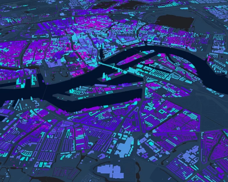
This digital twin of Rotterdam, Netherlands, uses a GIS basemap with information coded by color to identify buildings by age. Image courtesy of Esri

March 23, 2023
Piper

Jamaica station in Queens is one of New York City’s most vital transit hubs, a stop for most Long Island Railroad routes with connections to several subway lines and the AirTrain to John F. Kennedy International Airport. On weekdays, 200,000 riders make it the nation’s second-busiest commuter rail stop and the fourth-busiest train station overall. Anything that impedes its functions—such as problems with the tracks, railbeds, or signaling systems—could disrupt New York’s overall transit system.

Architects and engineers have always taken a long view when designing critical infrastructure, such as Jamaica station, mindful that their creations will need to remain robust well into the future. The era of climate change has both reinforced and complicated this imperative. Now, they must ask additional questions: How strong must a bridge be to withstand increased storm surges? How should new rail lines and roadways be constructed if once-a-century floods now occur every decade and at higher levels? 

These questions demand a new approach. A “smart infrastructure” approach provides real-time insights for the present and data-driven planning for the future. This is possible thanks to the proliferation of sensors, other IoT devices, imagery data, historical data, and advanced analytics combined with geospatial technology that provides the context of geography. Key to planning and upgrading critical assets is understanding how infrastructure systems relate to communities and natural systems—what is happening where. That is why many construction professionals now use digital twins backed by a geographic information system (GIS). GIS software has the power to make sense of many different kinds of data and update it in real time. When geography and data are combined, infrastructure can be better managed for the greatest impact.

During a project’s planning stage, a GIS-powered digital twin can be used to run simulations and perform predictive analytics using location data to determine the effects of design decisions on the community and environment. As construction begins, the same twin may be used as a shared view of progress, ensuring that the process is unfolding as planned. It can provide a powerful diagnostic tool for understanding and modeling the effects of climate scenarios decades into the future and hundreds of miles away.

From a single train station to an entire network of railways and ports within a city’s supply chain, location-intelligent digital twins are enabling construction professionals to build smarter infrastructure for a continuously changing world.

Digital Twins and the Fifth Dimension

Jamaica station has recently undergone major renovations. HNTB Corporation, the engineer that won the contract, replaced critical power and signal systems, extended station platforms, and built two new tracks.  

The work involved extensive use of what HNTB calls a “5D” digital twin. In addition to being a 3D simulation of real-world infrastructure, the twin integrates the dimensions of time and money. Linking the various stages of the project, the twin formed a record of progress as work moved from the design stage to construction. The tool helped to unite the many partner agencies and private sector contractors working on a construction project in one of the city’s most dense transit areas.

A digital twin can go beyond mirroring the project itself. It can be expanded to simulate how the project will affect—and be affected by—existing nearby systems.

This expansiveness has enormous value, allowing project managers to understand the ripple effects of climate change. For example, although Jamaica station itself may not be vulnerable to flooding, some of the routes that stop there travel through hurricane storm surge areas near Long Island’s Great South Bay. The interruption of those routes could potentially increase ridership on other routes, and Jamaica station must have the track infrastructure to adapt to these changes.

From Trains to Ports to Supply Chains

GIS and digital twins present advantages for regional rail systems, but also play a vital role in steadying and improving international supply chains.

Seaport Simulator, a predictive analytics tool developed by the engineering firm Atkins, helps major ports worldwide understand how a changing climate will affect their operations. 

The program works by generating a digital twin of a seaport or trade area, including all supply chain nodes that link the port’s products to the rest of the world. This has direct relevance for port management. The Port of Prince Rupert in British Columbia, currently handles 35 million tons of cargo each year with plans for future growth and development. It moves cargo to and from Asian markets, and also connects to rail lines that carry it throughout North America. 

With the digital twin in place, Seaport Simulator then uses a combination of historical local weather data and global climate model projections, generating thousands of possible realizations of estimated future weather across the supply chain of interest from present day to mid-century. It then simulates cargo moving through the supply chain while being disrupted by predicted future weather events.

Prince Rupert’s location has the continent’s second-highest rainfall, including hurricane-level storms, and a 25-ft tidal swing. The study conducted with Seaport Simulator gave the port’s management an idea of how a warming planet could affect operations through 2050, at a granular level of detail that helps management make specific changes and recommendations based on its estimates to their policies and infrastructure.

Of particular value to port managers is the big-picture view of the supply chain years into the future. It allowed supply chain managers to evaluate if a proposed improvement to a set of rail tracks hundreds of miles away from the port would be sufficient to handle events like atmospheric rivers, which are projected to intensify in future decades.  

Location Intelligence at the Civic Scale

Able to depict entire cities and even nations, GIS-powered digital twins allow leaders to zoom out further. In the cities of Prague and Uppsala, Sweden, digital twins help city planners visualize how to transform old neighborhoods and create new ones, with an eye toward demographic projections and climate change mitigation. 

In the South Korean city of Incheon, planners created a 3D base map from Lidar scans, and then built a digital twin for analyzing construction projects. It has evolved into a multi-purpose civic tool, used by sanitation, fire, traffic, facilities, development, and revitalization departments. 

Island nations especially vulnerable to climate change are using GIS-based digital twins to understand how best to adapt. In Singapore, a “digital maritime atlas” is evolving into a digital twin that will reflect real-time changes in coastal areas. In Grenada, machine learning tools helped create the kind of realistic twin that would have otherwise required months and hundreds of work hours.

Once a spatially-aware digital twin is in place, it can evolve and adapt to community needs and new applications—acting as a location-intelligent system for the built physical world. As climate and population changes continue to impact our world and shape the way we design cities, we will need more of this intelligent, data-centric, and dynamic infrastructure.

Matt Piper is the Global Director for Industry Solutions at Esri and Leads the Utilities, Water and AEC Sectors. He is a professional engineer who has 20 years experience working in the utilities industry.


KEYWORDS: Digital Twins Esri GIS

Share This Story


ENR Subscribe


Matt Piper is the Global Director for Industry Solutions at Esri and Leads the Utilities, Water and AEC Sectors. Matt is a Professional Engineer who has 20 years working in the Utilities industry. Known for being a respected subject matter expert in Asset Management, GIS and Business Intelligence and as an Industry thought leader on how the value of GIS can be applied across an organization.


Post a comment to this article

Report Abusive Comment

Subscription Center
  • About ENR UNLIMITED
  • Join ENR UNLIMITED
  • Renew Membership
  • Create Account
  • Change Address
  • Pay My Bill
  • Free eNewsletters
  • Customer Care

More Videos

Sponsored Content

Sponsored Content is a special paid section where industry companies provide high quality, objective, non-commercial content around topics of interest to the ENR audience. All Sponsored Content is supplied by the advertising company. Interested in participating in our Sponsored Content section? Contact your local rep.

close
  • Egnyte two people
    Sponsored byEgnyte

    Building Resilience Today for Tomorrow’s Growth

Popular Stories

Workforce.jpg

Boosted by All Sectors, Construction Adds 25K Jobs in May

Gulf Shores Bridge.jpeg

Citing 'Personal Vendetta,' Alabama Judge Halts Work on $52M Bridge Project

Atlanta_crane_accident.jpg.png

Crane's Falling Counterweights Injure Four, Damage Atlanta Apartment Project

Iowa_Apartment_collapse_ENRwebready.jpg

Engineering Reports Highlight Iowa Building's Problems Before Collapse

SCV-Water-PFAS-Treatment-7_ENRready.jpg

DuPont, Spinoffs To Pay $1.19B in Largest Yet PFAS in Drinking Water Settlement

Industry Jobs


Webinar

Free Webinar


Events

June 13, 2023

Unifying Your Information: Using Email to Eliminate Project Delays and Rework

Unmanaged information such as important email correspondence can quickly become a chaotic, obtrusive, and risky burden on your organization. This webinar discusses what a Single Source of Truth is, and why it is critical to your business’ success. Join us to learn how you can benefit from unifying your project information.

Sponsored by:

Mail Manager

View All Submit An Event

Poll

How Do You Expect the Infrastructure Act’s Funding to Impact Your Firm?

What impact does your firm expect from future IIJA funding?
When do you expect states/localities in your area to start advertising Infrastructure Investment and Jobs Act-funded projects?
How do you expect the Infrastructure Investment and Jobs Act to impact your firm’s backlog in the next 2-3 years?
How would you describe staffing levels at your firm currently?
Since Jan. 1, what is the overall trend in your region for construction materials prices (year over year)?
View Results Poll Archive

Products

ENR Square Foot Costbook, 2023 Edition

ENR Square Foot Costbook, 2023 Edition

See More Products

Special Ad Section

ENR General Building Contracting and Engineering Today
 ENR GENERAL BUILDING CONTRACTING AND ENGINEERING TODAY
 View all Special Ad Sections
 Archives


Related Articles

  • Uppsala DT_780.jpg

    Why Your Digital Twins Need Location Intelligence

    See More
  • bentleyYII.jpg

    Infrastructure Act Can Drive Digital Twins, Says Bentley Systems

    See More
  • iTwin

    Success of Infrastructure Digital Twins Begins with Open-source Technology

    See More
×

The latest news and information

#1 Source for Construction News, Data, Rankings, Analysis, and Commentary

JOIN ENR UNLIMITED
  • Resources
    • Photo Submissions
    • Customer Service
    • Digital Edition
    • Survey And Sample
    • FAQ
  • ABOUT US
    • Advertise
    • FAQs
    • Contact Us
  • Subscription Center
    • Subscribe
    • Renew
    • Create Account
    • Change Address
    • Pay My Bill
    • Free eNewsletters
    • About ENR UNLIMITED
    • Customer Care
  • Privacy
    • PRIVACY POLICY
    • TERMS & CONDITIONS
    • DO NOT SELL MY PERSONAL INFORMATION
    • PRIVACY REQUEST
    • ACCESSIBILITY

Copyright ©2023. All Rights Reserved BNP Media.

Design, CMS, Hosting & Web Development :: ePublishing