The Reimagining of the LA River
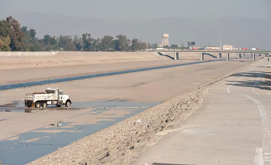
Photo courtesy Los Angeles County Public Works
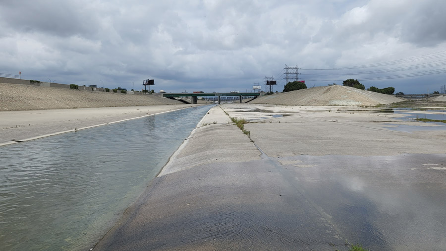
From the air, the concrete channel of the Los Angeles River is almost indistinguishable from the highways crisscrossing the greater Los Angeles area. The thin ribbon of water that flows down the channel can be hard to discern from afar; expected vegetation is conspicuous by its absence.
This is the price the city has paid for security from torrential flash floods which have proven devastating to the region in the past. And the social cost of the concrete-lined river has been high as well. Instead of being a focus for communities along its 51-mile-long course, the river separates them, exacerbating profound cultural and economic divisions.
The Los Angeles River Master Plan, adopted by the Los Angeles County Board of Supervisors last month, aims to address some of these disparities as the process begins to restore portions of the waterway. County officials estimate that implementing all projects in the plan would cost between $19 billion and $24 billion over the next quarter-century. Among the future work identified in the plan are parks, trails, floodplain reclamation, community centers and construction of low-income housing.
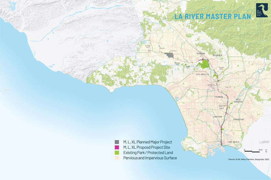
The 51-mile course of the Los Angeles River from its headwaters in Canoga Park to its mouth in Long Beach is almost completely encased in concrete for flood control. The LA River Master Plan includes parks, trails and other infrastructure to enhance communities along the waterway.
*Click the image for greater detail
The new master plan was developed by Los Angeles County Public Works, which oversees the river as part of the waterway’s flood control district. The $8-million planning effort was launched at the request of the board and has been led by a 41-member steering committee representing a gamut of key stakeholders.
“[Los Angeles County Public Works] had an outline in mind but we had to really go out to community and pull them through a significant engagement process and understand what their needs were,” says Carolina Hernandez, assistant deputy director, LA County Public Works. Since 2019, more than a dozen public community meetings have been held, and 15 events were coordinated with 10 local community organizations.
Also contributing to the plan as consultants were architect Frank Gehry and his firm Gehry Partners, landscape architecture firm Olin, and engineering firm Geosyntec.
Photos by C.J. Schexnayder for ENR
The Source of the Waters
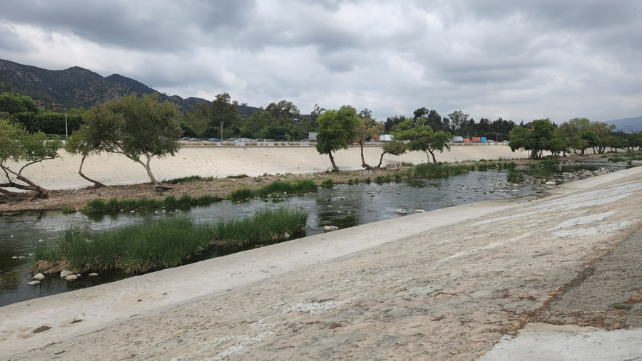
The Los Angeles River begins at the convergence of two streams in the Canoga Park neighborhood of the city of Los Angeles. It flows 51 miles from there to its mouth in Long Beach, crossing through 17 cities along the way. As an alluvial river, the waterway lacked a deep channel, making it susceptible to severe flooding when heavy rainfall occurred. Floods regularly devastated communities that were built close to the waterway. A series of major inundations in the 1930s and 1940s prompted more comprehensive efforts to mitigate the danger to residents and businesses.
The U.S. Army Corps of Engineers led the effort to create the river’s concrete channel, seeking to control the flow of water in a fixed course held in with large floodwalls. There was little public outcry about this at the time, notes Blake Gumprecht, author of the 1999 nonfiction book on the subject, The Los Angeles River: Its Life, Death and Possible Rebirth.
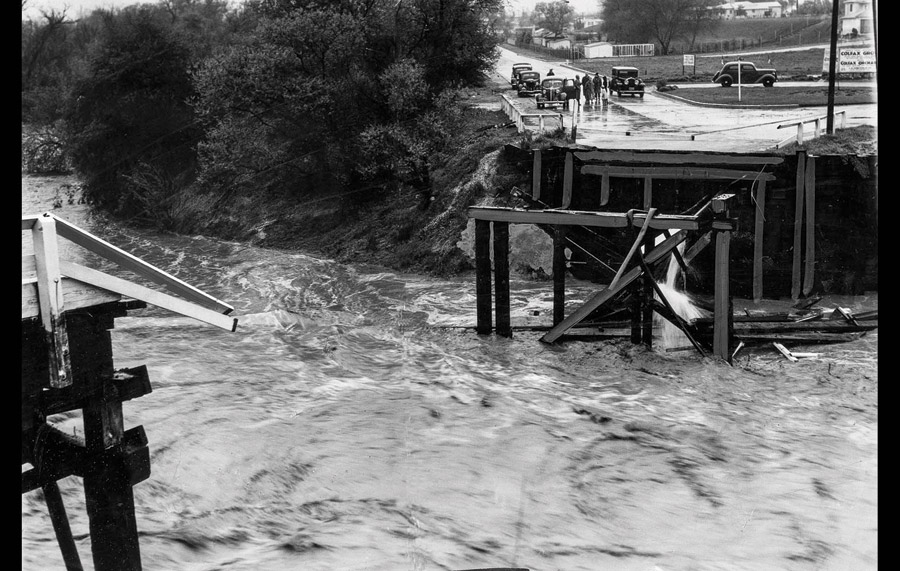
The shallowness of the Los Angeles River’s natural channel created a flood risk during severe rain events. Severe flood damage in the 1930s prompted efforts to reshape the channel.
Photo Courtesy the Los Angeles Times
“Back then nobody was standing up for the river because it was just seen as this eyesore that threatened properties when it flooded,” Gumprecht says. “There was nobody crying out to protect the Los Angeles River until the late 1990s.”
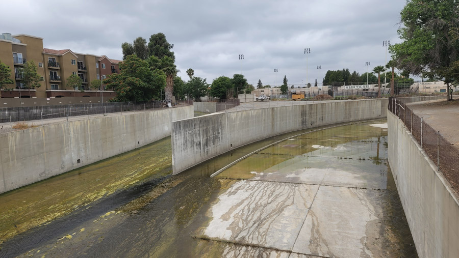
The reduced risk of flooding allowed communities to develop near the waterway, but all but eliminated the river’s ecosystem. Ironically, the Los Angeles River has since became a cinematic icon, serving as an enormous paved setting for vehicle chases in films such as Grease, Terminator 2: Judgement Day and Drive. Television shows and music videos have also made use of its distinctive, wide-open aesthetic.
But there was also a socioeconomic toll. The concrete channel divided communities along its corridor and almost any meaningful interaction with the waterway by residents ceased. Those communities, particularly toward the southern end, tended to be poorer and populated by racial and ethnic minorities.
Today, the river’s corridor includes more than 2,300 acres of publicly owned land, and approximately one million people live within a mile of the waterway.
In 1996, a master plan for the river was created by Los Angeles County with the intent of obtaining state and federal funding to revitalize the waterway. The plan offered strategies for flood control, but also included environmental mitigation that had been overlooked in years past. What was missing was any focus on equity or the social impacts of major infrastructure on communities.

The expanse of the Los Angeles River channel provides an opportunity for community events such as the SELA Arts Festival, held annually in the river channel in the city of South Gate. Infrastructure such as parks and bike trails would connect these efforts and encourage interaction along the waterway. Planners held public meetings with community members to determine the best approaches.
Photo courtesy Los Angeles County Public Works
Over the following decades, no fewer than five different plans were created by various agencies to manage various aspects of the river’s impacts, including environmental revitalization and control of water flow.
“What we wanted was a more a unifying plan that is updated and includes consideration of gentrification, culture, [and] cultural competency,” says Mark Pestrella, LA County Public Works director and chief engineer of the Los Angeles County Flood Control District.
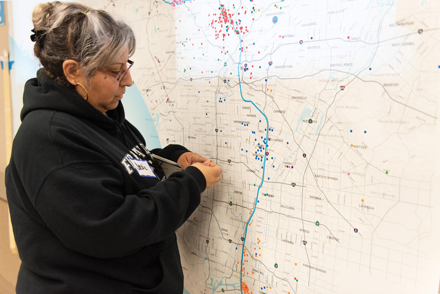
Photo courtesy Los Angeles County Public Works
The new master plan incorporates guidelines established in the previous plans but also includes a master list of priorities that include water reliability, equitable access, ecosystem development and community outreach.
“I do think the LA River Master Plan has the potential to be as transformative as promised,” says Jon Christensen, environmental historian and adjunct associate professor at UCLA who has studied the efforts to revitalize the river. “It all depends on implementation.”
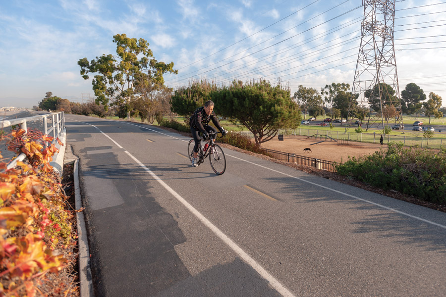
Photo courtesy Los Angeles County Public Works
Enacting the Master Plan
With the adoption of the Los Angeles River Master Plan (LARMP) by the Board of Supervisors, the priorities identified in it can now be integrated in the county’s capital improvement plan. The board has already directed county staff to implement planning for the projects identified within it by all 10 county departments, not just public works. The first report will be presented to the board next year and will include cost estimates and prioritized items of the plan. It will be revised on an annual basis.
At the same meeting where the master plan was approved, the Board of Supervisors approved the establishment of a land bank to provide affordable housing in river-adjacent communities. One of the key concerns for low-income residents living near the river was the possibility that planned improvements could cause a surge in housing costs, forcing them out.
The measure allows the country to purchase and hold land, with the intention of building lower-income housing in the future. Without it, the planned improvements from the master plan could drive increases in property values beyond the reach of the area’s current residents.
The board directed $50 million in federal funds from the American Rescue Plan Act of 2021 to be directed to the program—enough to purchase land for about 800 units of affordable housing. The master plan projects 5,200 such units will be required in the coming years.
More importantly, by establishing the land bank the county aims to demonstrate that the master plan isn’t just an aspirational exercise with nothing tangible to show for it, Christensen explains. “The county made a really important move, not just a gesture, but a concrete move, to demonstrate its commitment to equity by establishing a land bank,” he says.
“I do think the LA River Master Plan has the potential to be as transformational as promised.”
Jon Christensen, Adjunct Professor, UCLA
The master plan is also designed to facilitate financing for projects described within it. As part of the development of the master plan, the county also created a Program Environmental Impact Report to evaluate any potential impacts to the environment.
That document provides the information needed to produce grant applications and permitting. That not only cuts the development time for grants, but it also shows how a given project would fit within the wider scope, particularly in terms of how it can serve disadvantaged or underserved communities.
“The plan includes the data showing what those communities wanted and a framework for achieving it,” says Keith Lilley, Deputy Director of Water Resources for Los Angeles County Public Works.
As local and state legislation has emphasized environmental justice for disadvantaged communities, the plan also provides detailed information about these communities in the river corridor and identifies programs to assist them. There are also elements in the plan for legislation addressing topics such as climate change and homelessness.
Environmental Concerns
One thing the plan will not accomplish is the wholesale removal of the river’s concrete channel. While there are plans to enhance sections of the river with natural landscapes and develop side channels with natural environments, the main course of the river will remain paved.
Maintaining the current flood capacity of the river with a natural river course would be impossible without a massive land acquisition program to acquire the real estate needed to widen the channel sufficiently.
Given the lack of a comprehensive element to remove the concrete bed and restore the natural course of the river, several key environmental groups—including several members of the plan’s steering committee—withdrew their support for the master plan on the eve of its approval by the Board of Supervisors in June.
“The Plan affirmatively reiterates the LARMP team’s antiquated and harmful position that the LA River is nothing more than a flood control channel, and that nature-based solutions to remove concrete and remediate contaminated land are infeasible,” the group said in a letter to the board. They accused the organizers of ignoring input from them as well as other key stakeholders such as Indigenous groups historically associated with the river.
Pestrella says the accusations don’t accurately represent the wider effort to integrate the concerns of all the stakeholders involved in developing the master plan. In areas of the lower river, which tend to be less affluent and more susceptible to flood risks, “the community wholeheartedly pushed back on the idea of naturalizing the river,” he explains. “The plan represents a balanced community voice where all voices have been heard and considered,” he says. “We intend to continue to partner with them now and in the future.” He added that environmental concerns will continue to be integrated into the plan as specific projects are identified and move through federal and state permitting processes, as well as required by the county’s own environmental policies.

Architect Frank Gehry has proposed a series of park platforms to be constructed over the river channel. These would be integrated into parks and landscaping on either side of the waterway.
Image courtesy OLIN, Gehry Partners, Geosyntec.
From Plan to Projects
The LA River Master Plan contains provisions for parks and other river-adjacent amenities intended for communities located along the channel. These are intended to address the dearth of such facilities and services in these areas, while encouraging the public to interact with the river itself.
Dozens of previously funded projects along the LA River are already underway, such as an effort to connect a series of bikeways that runs along the channel into a more continuous network. In total, there are 22 major new projects and hundreds of smaller construction initiatives identified in the master plan, but many are not yet funded.
One key project is a headwaters pavilion to be located along the trail at the river’s source in Canoga Park. It would create a shade and rest pavilion with bike racks and picnic tables to draw people to the river.
“This is really meant to be the first flag in the ground or pilot project along the LA River,” says Genevieve Osmeña, Senior Civil Engineer for Los Angeles County Public Works. “It’s basically going to help us illustrate and show how all the tools and the guidance of the master plan can be utilized in an effective and a holistic way for communities along the river.”
The pilot project is currently under design and is expected to cost between $4 million and $5 million. Officials hope to put it out to bid by the end of this year.
More ambitious efforts are in the works as well.
Architect Frank Gehry has proposed a $150-million cultural center adjacent to the channel, south of the Los Angeles River’s confluence with the Rio Hondo. The 85,000-sq-ft facility would feature two enclosed performance halls, public courtyards and a one-acre park. According to Gehry Partners principal Tensho Takemori, approximately half the funding for the project has been identified, and efforts to secure the remainder are ongoing.
A more ambitious and controversial proposal from Gehry is to build parks atop massive elevated platforms over the concrete-lined river channel. These platforms would span the entire width of the river channel, and some could be more than a mile in length. “The water is the devil 2% of the time and you can’t do anything about it,” Gehry explains, citing the risk posed by floods. “But it is possible to cover it and recapture the area on top.”
The parks would feature trees and landscaping as well as amenities such as ponds, footpaths and horse-riding trails. They would be integrated into landscaped corridors alongside the river channel.
While fully implementing the master plan will take decades, initiatives such as parks can have a more immediate impact, Pestrella says. “Where we’ve done some improvements like this, we have almost immediately seen the community adopt it as an asset,” he observes. “So we know there is the potential for the river to become this massive asset and a driver [to improve quality of life].”


