No End in Sight to Record Midwest Flood

A breach on the Arkansas River May 31.
PHOTO: YELL COUNTY SHERIFF’S DEPARTMENT VIA AP
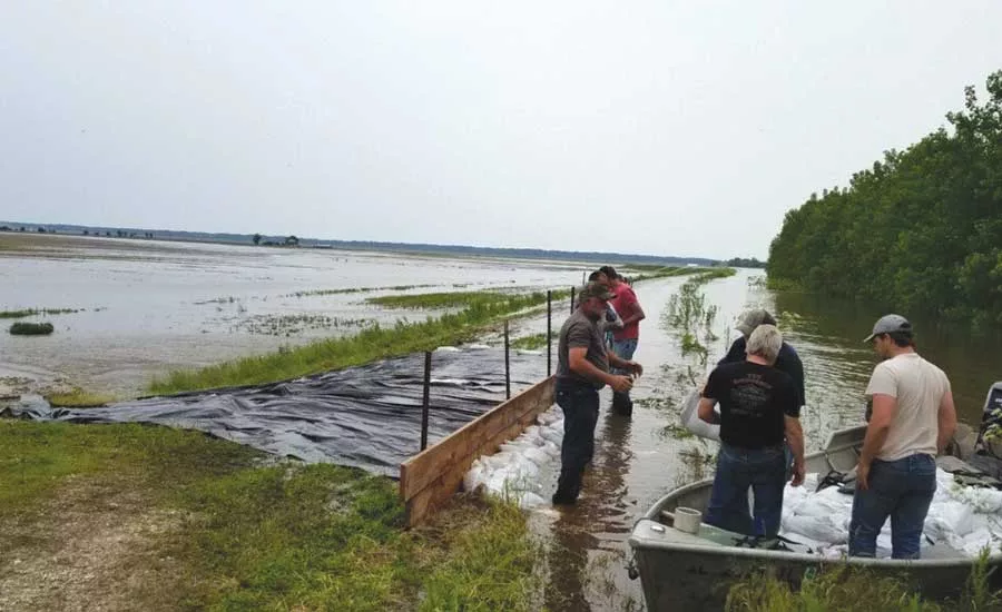
Volunteers near Meyer, Ill., work to save a levee near the Mississippi River.
PHOTO: USACE PHOTO BY CPT CHRISTOPHER GERVING, BATTLE CAPTAIN, QUINCY FLOOD AREA
The Missouri Dept. of Transportation didn’t even have time to fully assess the damage to its roads and bridges from late winter flooding before the next round hit.
“All of those damaged roads are back under water again,” says Ed Hassinger, deputy director and chief engineer for the Missouri DOT. Hassinger estimates the state has at least $20 million in damage to roads and bridges, but work hasn’t been possible because of the high water. The DOT lost at least two bridges completely, and several approaches to bridges that cross the Missouri have been undermined or are not safe for travel, he says.
For now, while design for some replacement work goes on in the office, DOT crews are in the field, making sure people don’t travel on the 300 to 400 roads that are underwater.
Similar tales are being heard up and down the Mississippi River valley. Waterways are swelling from rains that hit both east and west of the main stem. More than 380 river gauges were reporting levels above flood stage in late May.
“It’s been the wettest period since 1895,” says Joey Windham, chief of the watershed division for the U.S. Army Corps of Engineers’ Mississippi Valley Division. “It’s the highest amount of water that we’ve ever dealt with.”
As floodwaters from the Arkansas River, the latest river to flood, make their way to the Mississippi, Windham expects the Corps will be dealing with flood conditions in the lower Mississippi into July if rains continue.
“We don’t see any end in sight to the water,” he says.
Looking for quick answers on construction and engineering topics?
Try Ask ENR, our new smart AI search tool.
Ask ENR →
To manage the record levels, the Corps has opened the Bonnet Carre’ spillway in Louisiana a record two times this year and it is scheduled to open the Morganza spillway for the third time ever June 9. Levee breaks in Arkansas relieved pressure on the lower Mississippi and delayed the opening of the Morganza.
Levee breaches have been reported in Iowa, Missouri, Illinois, Louisiana and Arkansas, but none of them, Windham says, are part of the lower Corps-maintained and -managed Mississippi River and Tributaries system put in place following the 1927 floods. That system is showing even less stress than it did in the 2011 flood following work that was done to reinforce the levees, he says.
But breaks in agricultural and other levees outside of the system that are not built or maintained by the Corps, as well as other flood control practices in the upper Mississippi valley, are being scrutinized even before the waters recede.
At least 32 systems breached in March, flooding 114 sites, the Corps’ deputy commanding general, Maj. Gen. Scott Spellmon, told a senate committee in April.
Spellmon, in an email to E&E News last month, said the Corps is considering realigning levees along the Missouri or expanding or building new floodways or retention basins. A Corps spokesman didn’t reply to an ENR request to confirm that statement.
Others, including the group American Rivers, say the current levee system is overbuilt. “The levee is at a ‘choke point’ in the river where so much of the floodplain is blocked by levees that the river has no room to spread out when it floods,” American Rivers’ statement said.
The Sny Island Levee and Drainage District controls a 60-mile-long levee that goes from Quincy to Belleview, Ill. Michael Reed, superintendent for the district, disagrees. He said that in addition to sheltering farmland, the levee protects interstates 72 and 172 on the Quincy side; the highway bridges from Illinois to Hannibal, Mo.; local railroad lines; and several towns.
The arguments, which are repeated after every major flood, can be resolved, but not in a piecemeal fashion, says Gerry Galloway, a civil and environmental engineering professor at the University of Maryland and a water management expert. Galloway was appointed by then-President Bill Clinton to review the 1993 Midwest floods.
Following his review, he offered 97 recommendations to improve flood control and management, but only a small fraction have been implemented.
Just as he said in 1993 and has repeated in subsequent reports, Galloway says that the United States needs a unified effort to cohesively address problems in the upper Mississippi Valley, as it does in the lower half of the river. “We need to get the states and the local communities and the federal government all on the same sheet of music.”
Too often, he says, the politicians turn away from trying to resolve the problem because it’s too “thorny,” and the public has a short memory. But, he says, the problem is not going away.
“Everyone wants an answer,” he says. “We have the answers, we need to get about the business of it.”


.webp?height=200&t=1640294757&width=200 "Q4 Cost Report Equipment")
