Natural Disasters
Hurricane Harvey Damage Revealed in Aerial Photos
Coastal communities hit hard by the storm show aftermath of floodwaters and high winds
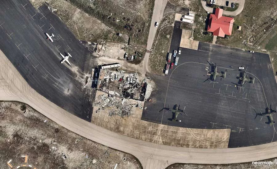
An aerial photo of the damage done by Hurricane Harvey to a building at the Aransas County Airport.
Photo Courtesy of Nearmap
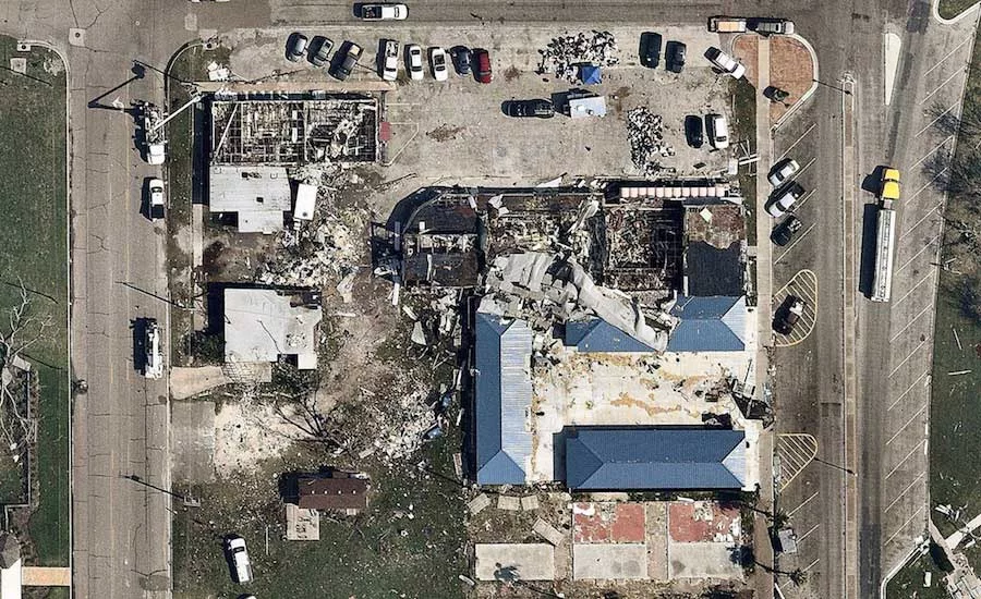
Hurricane Harvey damage to a commercial area near Corpus Christi, photgraphed on Aug. 31.
Photo Courtesy of Nearmap
Damage documented Aug. 31 in Rockport, near the center of Hurricane Harvey’s landfall.
Photo Courtesy of Nearmap
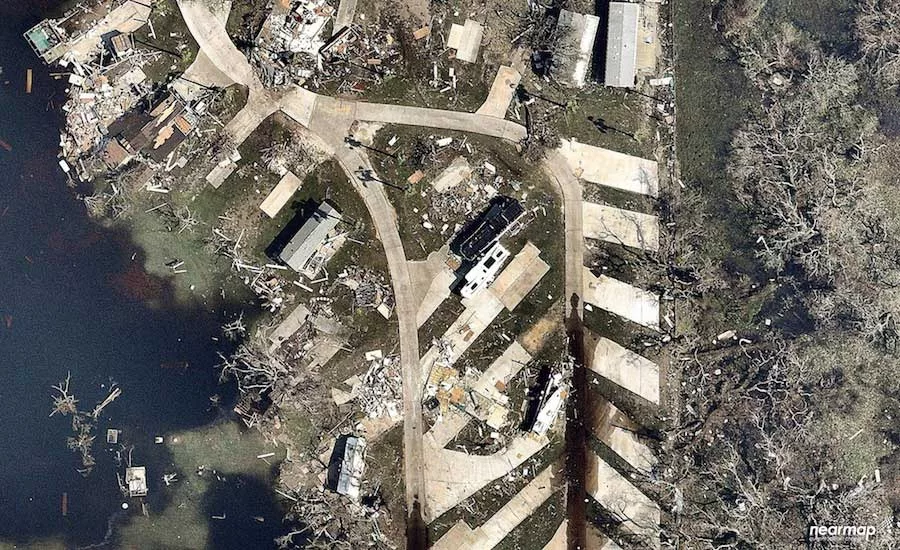
Flooding and damage to a trailer park near the Rockport/Ingleside area.
Photo Courtesy of Nearmap
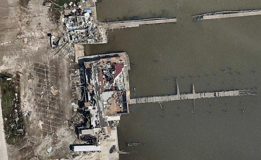
Damage at a dock in the Rockport and Ingleside area.
Photo Courtesy of Nearmap
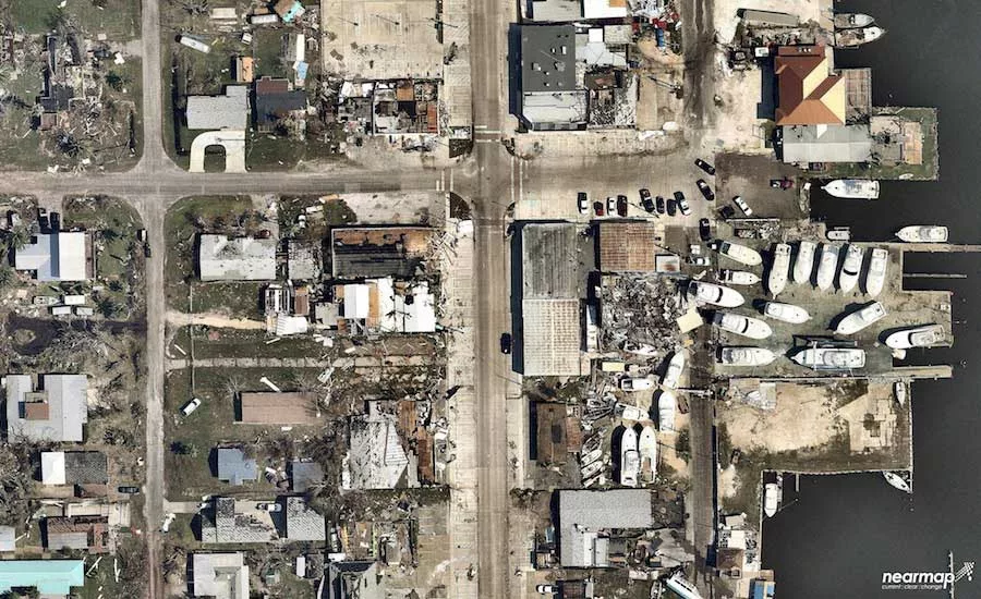
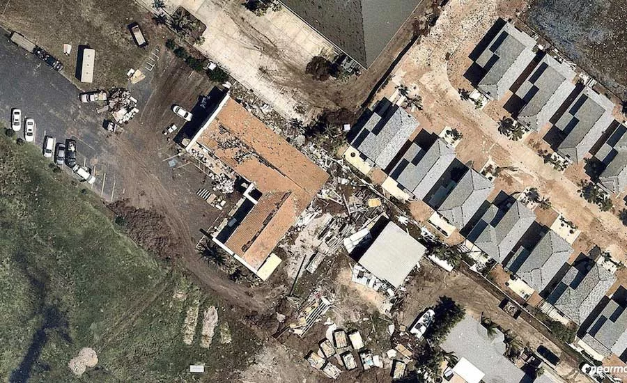
An aerial photo showing damage to a commercial and residential area near Corpus Christi on Aug. 31.
Photo Courtesy of Nearmap
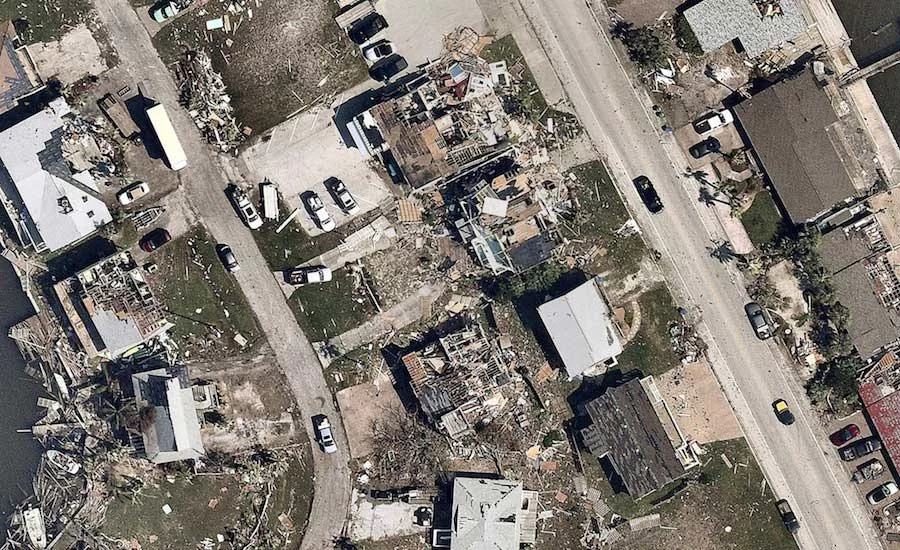
Devastating damage to homes in the Ingleside and Rockport area.
Photo Courtesy of Nearmap
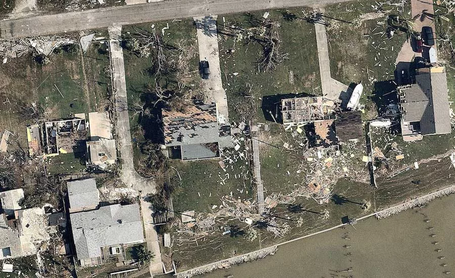
Waterfront homes were ripped apart and trees knocked down by Hurricane Harvey’s winds in an area north of Corpus Christi.
Photo Courtesy of Nearmap
Nearmap, which produces high-resolution satellite imagery for construction and engineering firms, governments and utilities, conducted a flyover of Rockport and Ingleside, Texas, north of Corpus Christi, on Aug. 31. This area is where Hurricane Harvey made landfall on Aug. 27.
These images capture some of the devastation from Hurricane Harvey’s winds to commercial corridors, residential areas, a local airport and a water-treatment facility.
Looking for quick answers on construction and engineering topics?
Try Ask ENR, our new smart AI search tool.
Ask ENR →


