Two East Coast deepwater offshore wind developers have deployed floating lidar systems to provide critical data about wind conditions high above the ocean’s surface that will help with blade and other equipment design.
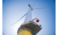
On June 2, the University of Maine, Orono, launched a floating lidar system beside the VolturnUS 1:8 floating offshore wind turbine, which was connected to the grid on June 13 at Castine. It is the first grid-connected floating wind turbine in North America. The lidar system detects wind conditions up to 600 ft above the ocean surface. AWS Truepower, headquartered in Albany, N.Y., plans to validate the data collected by the university’s floating system.
Offshore wind researchers and developers see lidar as an inexpensive, mobile option for determining wind-energy development potential in large swaths of the world’s oceans. Lidar is an active remote-sensing technique that is similar to radar, but it uses light pulses instead of radio waves.
Andy Clifton, senior engineer at the National Renewable Energy Lab’s National Wind Technology Center, Boulder, Colo., says placing lidar on a buoy is dramatically cheaper than installing a meteorological tower. The latter requires installation of a monopole-and-jacket foundation and typically costs between $3 million and $10 million, Clifton adds. “The biggest challenge [in developing floating lidar technology] is systems integration,” he says.
The University of Maine Advanced Structures and Composites Center and its partners—the school's Physical Oceanography Group; NRG Systems, Hinesburg, Vt.; AWS Truepower, Albany, N.Y.; and France-based Leosphere—are gathering deepwater hub-height wind and other meteorologic-ocean measurements in the Gulf of Maine. The university has designed a floating system to house a modified Windcube v2 Offshore Lidar Remote Sensor, adapted for a dynamic marine environment, the school says.
“Floating lidar technology, once fully validated, will provide us with a cost-effective method to assess wind resources in areas traditionally off-limits to offshore wind developers,” says Habib Dagher, director of the university’s composites center.
On June 4, Atlantic City, N.J.-based Fisherman’s Energy announced that it had moved its Wind Sentinel lidar buoy system from a test site near Atlantic City to an offshore area, leased from the federal government, 11 miles east of Ocean City, where it plans to begin building a five-turbine, 350-MW wind farm by year’s end.
“The device is now operating in 65 feet of water and transmitting environmental and meteorological data back to Fishermen’s offices to support wind-farm design and development,” says Stephen O’Malley, Fishermen’s director of metocean assessments.
Fishermen’s lidar system includes environmental monitoring sensors installed on a Navy oceanographic meteorological automatic device (NOMAD) buoy developed by the U.S. Navy in the 1940s and still used by the National Oceanographic and Atmospheric Administration and major oceanographic research institutions. The system employs a lidar wind-measurement device that provides information on wind speed, direction and shear from the water surface to a height of nearly 500 ft.
Chris Wissemann, Fishermen’s chief executive officer, says, “These measurements provide information for energy production estimates as well as details about wind effects across the rotor-swept area of the planned turbines.”
The system also collects oceanographic data using ocean-wave and -current meters that provide data on the forces that will affect the turbine foundations. The information will assist engineers designing structures to withstand extreme storm events.
Other companies around the world are developing similar systems, but Dagher says a successful launch of the university's first lidar buoy could lead to a product that would sell for between $1 million and $1.5 million per unit.
Clifton says there are six manufacturers and about 12 operational floating devices now in operation worldwide.


Post a comment to this article
Report Abusive Comment