RWDI Takes Wind Engineering to New Heights
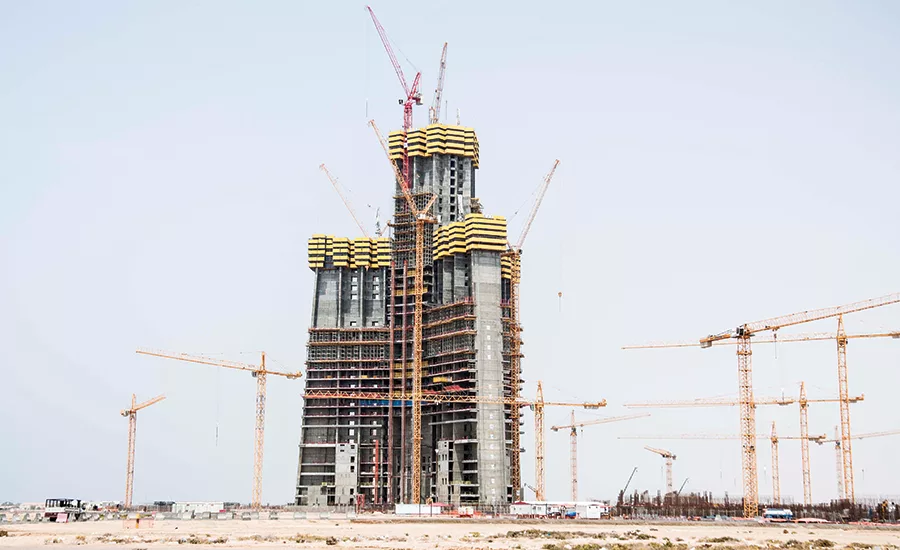
Jeddah Tower, now 180 m tall, inspired innovative wind engineering.
PHOTO COURTESY OF JEDDAH ECONOMIC CO.
When the framers of the Jeddah Tower—designed to rise higher than 1 kilometer—needed advice on the wind climate about 500 m above the earth’s atmospheric boundary layer, they turned to RWDI Consulting Engineers and Scientists.
RWDI’s challenge was that the standard approach in wind engineering analysis wouldn’t work. Typically, an engineer develops a model of wind characteristics at the site, based on design wind speeds provided in building codes or generated from historical wind measurements, and then extrapolates up to the building’s height using simplified engineering models of the boundary layer, where wind speeds depend on the roughness of the topography, says Jon Galsworthy, an RWDI principal. But, above the boundary layer, weather is determined by the effects of larger masses of air.
|
Click Here to Read RWDI Creates Better Habitats |
RWDI didn’t think standard practice would be good enough. Instead, it began by using historical data from the Jeddah Airport Metrological Station, including 17 years of wind data from balloons, and extrapolated the data using advanced simulation techniques. But that approach has its limits, says Galsworthy: Balloon data does not accurately represent wind climate in the upper reaches because balloons are launched only twice daily and rarely in storms. To get the hourly resolution needed to model the wind near the tower’s top, RWDI performed mesoscale modeling, using the state-of-the-art Weather Research and Forecast Model, which draws on the expertise and data of many governmental and academic institutions.
“Other wind engineers would have scaled up [from boundary-layer wind data] without even thinking about it,” says Robert Sinn, a principal of the tower’s structural designer, Thornton Tomasetti.
Looking for quick answers on construction and engineering topics?
Try Ask ENR, our new smart AI search tool.
Ask ENR →


