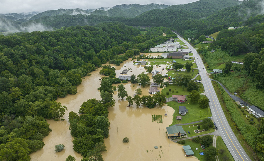
In the wake of devastating floods that killed 45 people in July 2022, Kentucky has brought on engineering firm Stantec for a $25 million contract to use machine learning for better flood risk mapping, assessment and planning services.
The five-year, single-award, task-order master services agreement with the Kentucky Division of Water (DOW) will focus on better planning to cope with flash flooding risks not previously identified in the state’s mapping program.
It will also be used to guide future building efforts, said John Mura, a spokesperson for the water division.
The cloud-based technology uses machine learning to provide insights and predictions on when and where flooding is likely to happen. The intent is to allow the water division and community officials to make more accurate and timely decisions and inform the public of imminent flood risk and the best evacuation routes.
Jeff Albee, vice president and director of digital services at Stantec, said the company will leverage improved artificial intelligence to determine flood risk.
“It’s really in the last couple of years that the types of production quality, scalable data analytics, AI and machine learning services and platforms have become commercially available,” he said.
Rainfall totals observed across eastern Kentucky were over 600% of normal during the 2022 flood, according to the National Weather Service.
Additional services under this agreement include assisting with developing 2D models of all watersheds in the state, which includes hydrologic and hydraulic modeling and mapping. These models will allow the state to provide up-to-date conditions assessment and better support data management and regulatory processes, Albee said.
Mura said the studies they are doing are "based on better data and modeling techniques than were available in the past. In some areas the new maps remain very similar to the old maps, in others there are significant differences."
Stantec has already begun 2D analyses, and will cover the state under the new master services agreement.
“An interesting challenge of this project will be developing statewide 2D risk map models through base level engineering and regulatory methodology,” said Mike Greene, Stantec principal and project manager. “It will provide better defined risk within the watershed as well as the flexibility to run multiple rainfall scenarios.
Much of the work under the agreement will support DOW’s role as a Cooperating Technical Partner with the Federal Emergency Management Agency. Under the agreement, Stantec will also assist the water division in its role as a Letter of Map Revision Review Partner, supporting commonwealth officials in reviewing floodplain updates.
“Stantec will continue to support DOW to meet their obligation to FEMA and the residents of Kentucky to create data to be used in decision making to prevent the loss of life and property,” Greene said in a statement.
“This agreement comes at an opportune time with the development of new technologies that can help us better understand the Commonwealth’s flood risk and prepare accordingly,” said Carey Johnson, director of DOW in a statement.
Stantec has done similar work in the region on flood analysis with public agencies, including a recent project with Tennessee to assess its periodic flooding from the Mississippi in the western part of the state. Stantec's software analysis tool for that, Flood Predictor, was developed in cooperation with the Tennessee Dept. of Economic and Community Development, using the agency's own flood data and other sources.
"Flood Predictor machine learning model is trained on FEMA RiskMAP modeling results and core inputs are derived from publicly available datasets," Albee said.
Albee notes the mapping process can be much quicker and more comprehensive using AI-based tools, but it is not necessarily affordable.
“It is quite costly, but basically with enough computer power we could map the flood risk of the entire USA on a daily basis,” he says.


