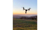
Hartsfield-Jackson Atlanta International Airport became the first U.S. international airfield to let drones fly within its controlled airspace when Atkins and its design-team partners, 3DR and Autodesk, flew a series of seven flights during a four-hour period on the morning of Jan. 10.
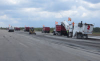
The team last year sought permission from the Federal Aviation Administration to use the drones at the world’s busiest airport to support construction of a ground transportation curb, including a canopy, passenger pickup and drive aisles, located between one of the airport’s SkyTrain stations and the site of a proposed hotel. Since FAA regulations prohibit unmanned-aerial-vehicle flights within five miles of airports, special authorization was required because the worksite lies between runways.
Atkins serves as the designer and civil engineer in a joint venture whose work will include the replacement of the airport’s north and south parking decks. The project is part of the ATL-NEXT $6-billion, 20-year expansion project.
According to Kevin Sartori, senior product marketing manager for the Berkeley, Calif.-based drone operator, 3DR, the team used a new FAA online portal, Part 107, in November to apply for a special waiver for the flight. It was approved on Dec. 15. The same portal also is used for applying for drone licenses.
As part of the flight authorization process, the applicants demonstrated to the FAA that, using the 3DR’s aerial data-capture platform, the drone could operate safely in the “critical location between runways,” Sartori says.
“The FAA approval required that we coordinate plans with the ATL air-traffic-control tower during the seven flights needed to capture the 700 images of aerial data of the 40-acre construction site,” Sartori said.
“Our flight team remained in radio contact with the ATL control tower at all times during the drone’s operation, which flew at a limited altitude of 200 feet,”
Sartori added. “They wanted to know where, when and the reasons, as well as how many people.”
Sartori noted that one of his 3DR colleagues, Jeremiah Johnson, is a licensed pilot of manned aircraft and familiar with the protocols of flying in a controlled airspace, which bolstered the application.
“For the large majority of construction sites, however, no authorization is needed, and the process is as easy as taking the new Part 107 remote-pilot test,” Sartori says. “That is the advantage of the new Part 107 regulation, enacted by the FAA in August 2016: It greatly lowers the barrier to entry for flying drones to complete commercial work.”
Chris Harman, senior project manager for Atkins, says the data acquired in the flights is used with “design in-reality” software, which allows for 3D immersion that provides many advantages for large projects, such as the Atlanta airport.
“If you can quickly and easily get a 3D version in front of a client, it avoids a lot of changes later on,” he says, adding, “Our team collected a great amount of accurate project data quickly, with no disruption to airport users.”
Harman says drones and photogrammetry allow for many photos to be stitched into a 360° image. Using the image to create a new design becomes fairly routine. All this is made possible by the integration of drones and software, he observes. “I see this happening on more and more projects, providing low costs and faster time-to-achieve with a big payoff,” he says.


Post a comment to this article
Report Abusive Comment