Coal Mining Region Needs Better Maps Underground
Two recent coal mine accidents in Appalachia have led to calls for establishment of national standards for documentation of underground mines and for a reassessment of the state of technologies, such as remote sensing and mapping, available for the task.
But experts in the field say the rough terrain and geology of the eastern U.S. coal regions will make this a particularly difficult problem for any one technology to solve. "There is no silver bullet," cautions Don W. Steeples, professor of geophysics who specializes in remote sensing at the University of Kansas in Lawrence.
 |
| ROBO BAT Robots that crawl or swim through abandoned mines while mapping with sound waves are being tested. (Photo © McGill Uninversity) |
Options being examined include techniques already being applied, such as seismic and electromagnetic systems and ground-penetrating radar, as well as some new ideas that are in research. One of those, which has just been put on a 100-day fast-development schedule in response to the issue by Carnegie Mellon University, Pittsburgh, uses self-navigating robots armed with laser or acoustic scanners to enter, explore and map sealed and even flooded mines.
The need for a renewed effort to ensure the accuracy of mine documentation was most recently brought into focus in late July when nine men were trapped in the Quecreek Mine, in Somerset County, Pa., when a barrier that separated them from an adjacent flooded mine failed and water rushed in. The men huddled in a small air space until they were rescued three days later.
The Dept. of Labor's Mine Safety and Health Administration began an investigation Aug. 1. An inaccurate map of the abandoned mine, closed since 1963, is believed to have misled the miners into thinking the barrier was thicker than it was. MSHA's national project will identify old mines, review existing maps and search for technological innovations that could improve mine mapping, particularly of abandoned and sealed works, to help prevent such incidents in the future.
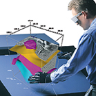 |
| VIRTUAL GEOLOGY 3D visualizers turn terabytes of seismic data into ethereal models. (Photo coutesy of Fakespace Systems Inc.) |
The Quecreek incident was the latest of many accidents in which mine maps played a role. Fines are still being settled on a coal waste impoundment blowout that released blackwater slurry into a watershed in Kentucky and West Virginia in October 2000 (ENR 8/12 p. 14). In that incident, the sealed entrance to an abandoned mine in the basin of the impoundment failed and channeled 250 million gallons of water and 31 million gallons of coal waste through a pair of portals two miles apart. That prompted a cry from investigators for better assessment of impoundment basins, including investigation of old mines within and around impoundment sites.
"It's hard to build a dam out there without a mine under it," says engineer Luke Williams of AMEC Earth & Environmental Inc., Philadelphia. "All the good sites are gone. Just about every hollow you find in the coal regions probably has some undermining."
David E. Ott, AMEC's senior project manager for coal mine impoundment sites, says his firm uses a combination of high- and low-tech tools, depending on site conditions. "None are particularly well-suited to Appalachian coal country, unfortunately," he says. "All have some limits." Ott says engineers usually end up doing the low-tech option. "You just dig," he says.
Getting into sealed mines is often out of the question. They frequently have areas of collapse or flooding, which is where William L. (Red) Whittaker, professor of robotics at Carnegie Mellon's school of computer science, believes some of the robots being developed there can help. They can be programmed to use acoustic or laser sensors, climb and swim, and navigate by applying artificial intelligence.
"We've built the capability for machines to sense and think and act. That's necessary for them to operate on their own," he says. "It's the rat solving the maze problem, which is important when the robot returns for charging and data downloads."
Whittaker predicts there will be a class of machines that can be lowered through bore holes for mine exploration. "Think of those kids' toys–transformers. Once you get them through the portal or hatch, you open them up," he says.
Acoustic sensors can work well in either a submerged or dry setting, and relatively low resolution could be adequate, he says. One version uses a spherical scanner that emits from a point and measures distances to surroundings in all directions as the robot moves. It is able to match the data as it moves, creating a continuous, self-referenced map.
Another approach uses a radial scanner that cuts a plane or slice of data perpendicular to the robot's direction of travel, building a sectional model. In addition to mapping abandoned mines for safety reasons, Whittaker says there will also be value in making volume estimates of unextracted reserves and in computing taxes on mineral rights more accurately.
"My position is to push the technology and exhibit those capabilities in short order," Whittaker says. Robotic sensing development will deliver a new form of engineering service and a tool for mine surveying, he says.
 |
| OIL TECH Mine mappers may adopt oil exploration tools. (Photo coutesy of Fakespace Systems Inc.) |
Roland Gritto, a geophysicist in the Earth Sciences Division at Lawrence Berkeley National Laboratory, Berkeley, Calif., says one remote sensing approach increasingly being used in coal country transmits seismic energy horizontally through coal seams. It can play a part in locating old mines by detecting voids and fractures and profiling old workings within the seam. "The coal seam channels energy the way a fiber-optic cable keeps the light inside," he says. Receivers bored into the seam can read the transmission from a distant location.
Seismic sensors are also deployed in arrays within and surrounding areas being studied for impoundment basins. The source signal may feed dozens of receivers that map the intervening subsurface features, which may be displayed through virtual reality tools such as the ImmersaDesk, from Fakespace Systems, Kitchener, Ontario. It is one of several visualization tools already being used for oil explorations. But the steep and fractured terrain of Appalachia creates many problems setting seismic arrays up and interpreting the data.
If active settlement is occurring on a fairly large scale, synthetic aperture radar images from satellites, which can read small changes in surface elevation and detect subsidence over relatively broad areas, may also be of value. But Appalachia's rough terrain and heavy vegetation limits application.
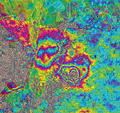 |
| SPACE DATA Satellites can spot subsidence but rough terrain limits effectiveness. (Photo courtesy of Vexcel Corp.) |
Whatever the technology used, it must be selected with the target in mind. That means researching old maps and all available data, and then selecting the sensing system to match the expected target. Searching for a deep, large cavity may call for one type of signal, while looking for smaller, shallow workings will call for another. Evidence will still simply be a signal that departs from the norm, says Gritto. It must be interpreted correctly, and ultimately, the definitive answer will still lie at the end of a test bore hole.
Steeples says the good news is that seismic technology is improving, including the software and systems for three-dimensional processing and display. Costs also are beginning to come down. "It has certainly been shown that 3D is cost-effective in the oil industry," he says. "At some point it is going to be cost-effective in some coal cases too."
But he cautions that, at the present state of the technology, even the lack of signal anomalies with remote sensing techniques cannot be taken for a definitive evidence that the geology is sound. "The absence of evidence is not evidence of absence," Steeples says.