Faced with chronically underfunded budgets, public-works officials are emphasizing technology-based solutions, such as drone surveys to inform preliminary designs and adaptive traffic signals to maximize corridor movement. They also are speculating on how connected vehicles will affect infrastructure management.
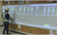
In Maricopa County, Ariz., a test bed of 51 adaptive traffic signals will launch next year to monitor traffic around the city of Scottsdale, said Faisal Saleem, intelligent transportation systems (ITS) branch manager for the Maricopa County Dept. of Transportation. Signals will recalibrate in response to specific situations. For example, if there are many pedestrians at an intersection, the traffic light might stay green longer.
When connected vehicles (CVs) begin to join the mainstream, traffic engineers anticipate an estimated 80% reduction in related fatalities, Saleem told attendees of the American Public Works Congress in Phoenix last month. CVs may imply potential dedicated lanes, adjustments to existing lane widths and pavement thicknesses, and parking, he added. "The 21st-century transportation landscape is changing very quickly," he said.
Technology may also be used in response to future emergencies. In Rancho Palos Verdes, Calif., PV Net, a non-profit technology education group, enlisted students to build drones that mapped a 200-ft-deep, 8-sq-mile landslide, said Michael Throne, city public-works director. A 3D-printed map of the landslide area was created from drone images using differential analysis. Now, the city is developing a road assessment test; if the landslide causes damage, the data can be used to prove that it is eligible for emergency funding, said Throne.
Citizens', utility owners' and other entities' privacy and security issues remain a big challenge. Also, long-term master plans may become obsolete due to rapidly changing technologies, Saleem noted.


Post a comment to this article
Report Abusive Comment