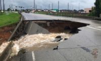
Superstorm Sandy destroyed the shorelines and seabeds of the East Coast to such an extent that federal agencies plan to remap the coastline.
The U.S. Army Corps of Engineers, U.S. Geological Survey and National Oceanic and Atmospheric Administration (NOAA) are using emergency supplemental funds to survey the coast to collect high-resolution topographic and hydrographic data. The LiDAR surveying will be recording water depths and any submerged debris that may have altered shorelines from South Carolina to Maine.
The $50-million project will begin work this fall. Some contracts already have been awarded, with more to follow in 2014, says Ashley Chappell, integrated ocean and coastal mapping coordinator, NOAA. Most data acquisition is scheduled to be finished by spring 2014, she says.
The data will determine estimated height-of-storm surge waves, which will inform decisions about, for example, where schools are built and how infrastructure is protected, says Chappell. The three agencies are working together to finish as quickly as possible.
"We're not each mapping the same areas," says Chappell. "We're joining forces to leverage the combined personnel of all our agencies."
She says the agencies will use the data for different projects, such as scientific studies on hurricane recovery, rebuilding activities, watershed planning and resource management.
Survey areas were based on requirements from federal agencies, stakeholders and governmental bodies as well as the National Geodetic Survey Remote Sensing Division's recent evaluation of the shoreline, says Chappell. All findings will be made available to the public on NOAA's Coastal Services Center's Digital Coast website.


Post a comment to this article
Report Abusive Comment