Fundamentals of Surveying: Calculating Traverses is Easier Using the Azimuth Trick
Calculating the traverse that represents a parcel can benefit significantly from something that is not properly taught: The use of azimuths.
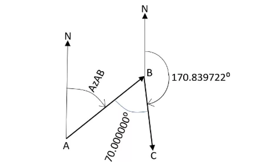
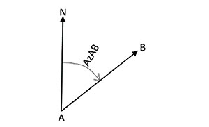
What is an azimuth? It is a horizontal angle of a line, with the zero at astronomic north, and measured clockwise. It can range from 0 to 360 degrees. Figure 1 shows that line AB has an astronomic direction of AzAB.
Those familiar with bearings will agree that the continuous handling of bearings in calculations is a pain. If all necessary bearings of a traverse are first converted to decimal azimuths, calculations become much easier.
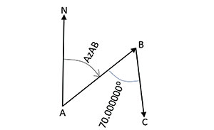
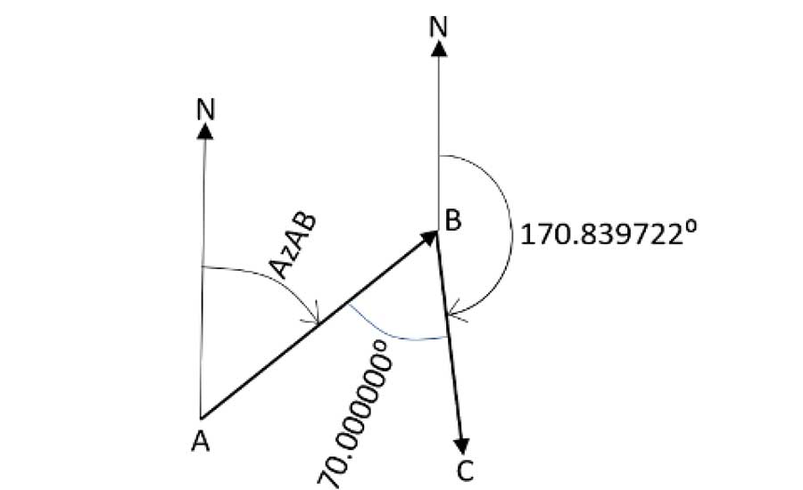
Let’s assume that line AB in Figure 1 has a bearing of N 60° 50’23” E. This converts to an azimuth of (60 + 50/60 + 23/3600) = 60.839722°. I like to use six digits for all angles. If I now have another traverse leg to a point C (as shown in Figure 2), and I measured an angle of, say, 70° 00’00” (or 70.000000°), what would be the azimuth of line BC? It is the azimuth of line AB, plus 180° (to get the direction opposite to line AB, or direction BA), minus the measured angle at B: AzBC = AzAB + 180° - 70.000000° = 60.839722° + 180° - 70.000000° = 170.839722°.
So, that is the azimuth of line BC. Let’s now add the north arrow at point B and draw the azimuth angle for line BC (see Figure 3). This shows that the azimuth of a line shows as much directionality as a bearing does. And, operations with Decimal-Degree (DD) format azimuths are much faster than with Degree-Minutes-Seconds (DMS) format bearings. In addition, the calculations and adjustments of closed traverses are more direct.
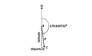
There are two things that need to be heeded. We come out of high school with the idea that a zero direction is along the X (east) axis, while azimuths have the zero direction along the Y (north) axis. This switches the trigonometry, as follows. Look at Figure 4, where I isolated line BC of the traverse. The departure (west-to-east) and latitude (south-to-north) components of line BC are shown as dashed lines and have the following values (using horizontal distance d): Departure = d*sin (AzBC) and Latitude = d*cos (AzBC). This goes contrary to high school trig because the sine is supposed to go up-and-down, not left-and-right. However, if we set the distance d = 500.00’, and calculate the latitude and departure values, the benefits of azimuths become apparent: Departure = 500.00’ x sin(170.839722°) = 79.60’ and Latitude = 500.00 x cos(170.839722°) = -493.62’. The negative value for the latitude tells us that we are going more south than north.
One of my favorite tools for calculations is Microsoft Excel, if I remember that it does not accept angle input in DMS format, but only in radians. Therefore, in Excel, the following formulae must be entered: Departure = 500.00’ * sin(radians(170.839722°)) and Latitude = 500.00 * cos(radians(170.839722°)). If one wants to convert radians back to angles, one uses the degrees function, like alpha = degrees (angle in radians).
Then, adjusting a closed traverse simply becomes a matter of adding up all those positive and negative departures to get a departure misclosure, adjusting departures, and calculating easting coordinates. This is repeated for latitudes and northing coordinates.
With this, I hope to have illustrated that geodesy is much more than just projections.
This article was originally posted on www.pobonline.com.
Looking for quick answers on construction and engineering topics?
Try Ask ENR, our new smart AI search tool.
Ask ENR →