The Time for Storm Preparations on the Carolina Coast is Over
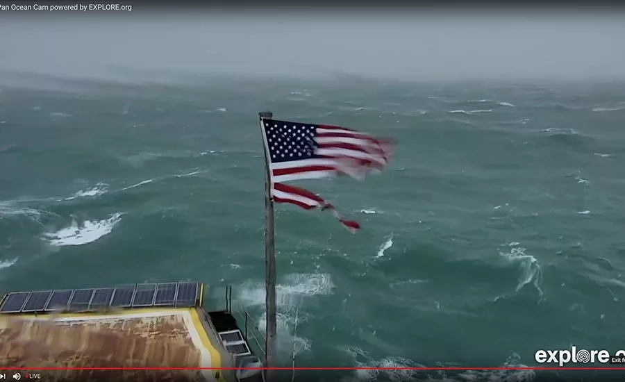
A live cam on the Frying Pan Shoals light tower 34 miles off the tip of Cape Fear in Southeastern N.C. has about 120,000 viewers taking bets on the survival of the flag or the solar panels in the view. Image courtesy of explore.org
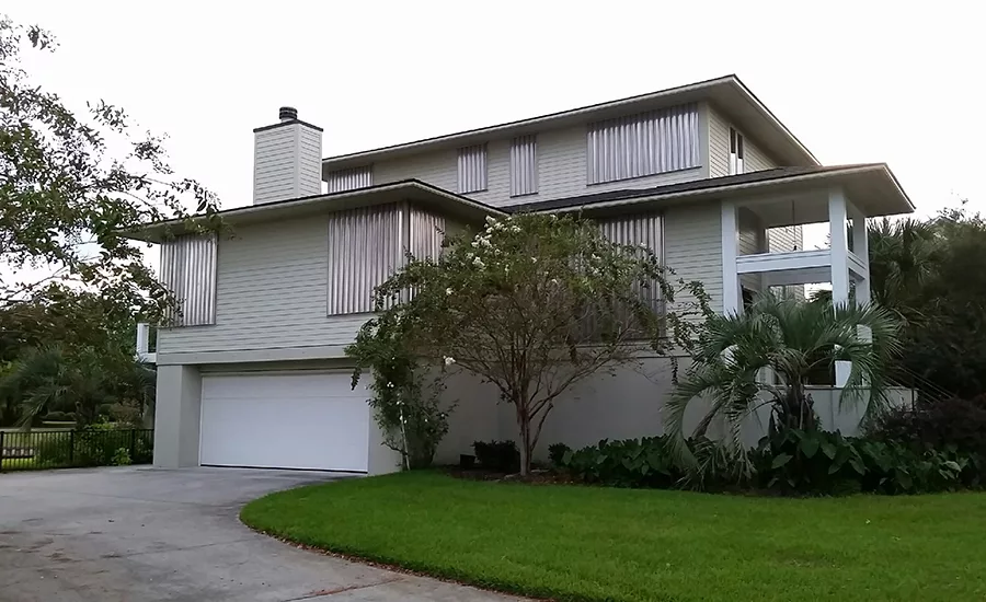
A home on the mainland just behind Wrightsville Beach, N.C. stands in full armor Thursday morning as Hurricane Florence approaches. Windows as large as 9 ½ ft square are protected by deeply corrugated and lapped 16-in.-wide aluminum sheets tucked into a pre-installed system of receiver channels at the top, set over studs on an L-channel track at the bottom, and secured by wing nuts with integrated fender washers.
The only windows not similarly protected because of access restrictions are glazed with impact resistant glass. The lower level of the house is designed to flood.
Architect and owner, John Sawyer, (and brother of ENR deputy editor Tom Sawyer) says this is the first time he and his wife have used the panels since building the house 12 years ago, but the pre-installed receivers made it relatively easy for him and his wife Becky to install. As per design, most panels could be placed by stepping over deck railings and walking on the roof, although a few required ladder access. “We did the biggest one first. The downside would be up on a ladder with the panels in wind,” Sawyer says. “That could be a problem. It wasn’t yet windy with any of them.”
The system is manufactured by Metal Tech, Inc., Hialeah, Fla. Photo by John Sawyer
Wind and surf are rising on the entire coast of the Carolinas as Hurricane Florence closes in Thursday afternoon. A live cam on the Frying Pan Shoals light tower 34 miles off the tip of Cape Fear in Southeastern N.C. has about 120,000 viewers taking bets on the survival of the flag or the solar panels in the view.
According to the National Hurricane Center’s 11 a.m. statement and 3 p.m. update life-threatening storm surge is now highly likely along portions of the coastlines of South Carolina and North Carolina. A Storm Surge Warning is in effect for a portion of this area. The greatest storm surge inundation is expected between Cape Fear and Cape Hatteras, including the Neuse and Pamlico Rivers and western Pamlico Sound.
Large swells and heavy surf are affecting portions of the East Coast, as well as Bermuda and the northwestern and central Bahamas. Those conditions are expected to continue this week, resulting in life-threatening surf and rip currents.
Life-threatening, catastrophic flash flooding and prolonged significant river flooding are likely over portions of the Carolinas and the southern and central Appalachians through early next week, as Florence is expected to slow down as it approaches the coast and moves inland.
Damaging hurricane-force winds are likely along portions of the coasts of South Carolina and North Carolina as soon as Thursday evening. a Hurricane Warning is in effect. Strong winds could also spread inland into portions of the Carolinas.
Looking for quick answers on construction and engineering topics?
Try Ask ENR, our new smart AI search tool.
Ask ENR →


