Taming the Red River: Innovative P3 Delivers Massive Diversion Project in North Dakota
November 8, 2023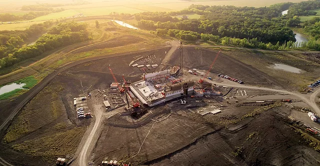
Taming the Red River: Innovative P3 Delivers Massive Diversion Project in North Dakota
November 8, 2023A series of projects, including the Red River control structure, which broke ground in 2022, is designed to work in tandem to address persistent flooding in the metro area.
Photo courtesy of Metro Flood Diversion Authority


Formed from an ancient glacial lake, the Red River Valley is famous for its flat landscape and fertile soil. Perhaps less known is that it is also one of the most flood-prone areas in the U.S.
Cutting through the valley, the northward flowing Red River winds its way from Breckenridge, Minn., to Lake Winnipeg in Canada, establishing most of the border between North Dakota and Minnesota. As snow melts in the valley’s southern regions each spring, the flows of the Red River and its tributaries are impeded by ice dams to the north, causing water to surge across low-lying farmland and towns. Flooding has been calamitous, particularly for the cities of Fargo, N.D. and Moorhead, Minn., which straddle the river. Many years, an all-hands-on-deck call has gone out to the community, launching an emergency sandbagging offensive to keep rising floodwaters at bay.
With the impacts of climate change, this exercise has become more common—and the Red River exceeded flood stage every year from 1993-2011.
In 1997, a catastrophic flood that caused $3.5 billion in damage, a record at the time, devastated the town of Grand Forks, just 80 miles north of Fargo. The community has just now gotten back to its 1997 economic and population levels after 25 years of recovery.
In 2008, the U.S. Army Corps of Engineers kicked off a feasibility study to manage the flooding. That effort evolved into the $3.2-billion Fargo-Moorhead Area Diversion project, which broke ground in 2017. Its 30-mile-long channel is the first public-private partnership done in conjunction with the Corps and the first water management P3 in North America. It is also the first green finance initiative in the U.S. specifically designed for climate change adaptation.
When it’s ready to operate in 2027, the first-of-its-kind design will provide a minimum of 100-year flood protection with the ability to fight up to a 500-year flood.
“Fargo will be one of the safest places to live,” says Joel Paulsen, executive director of the Metro Flood Diversion Authority, the North Dakota agency established in 2016 to oversee the design, construction, operations and maintenance of the diversion project.
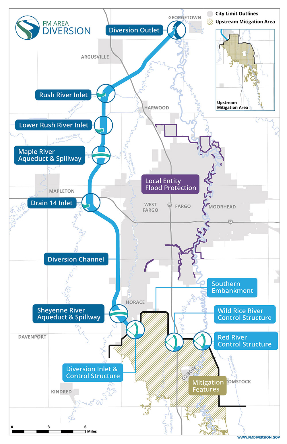
Gates on the Diversion Inlet structure near Horace, N.D., will open to allow floodwater stored behind the constructed embankment to enter the diversion channel.
Photo and map courtesy of Metro Flood Diversion Authority
*Click on the photo or map for greater detail
On the Brink of Disaster
More than a quarter of North Dakota’s economy is based in the Fargo-Moorhead area, which is home to three major universities, the only Level 1 trauma center between Minneapolis, Seattle, Denver and Omaha, and much more critical infrastructure that sits in the at-risk area that will be protected by the diversion.

When complete, the project’s innovative design will shield 44,000 acres and more than 235,000 people—along with their homes and businesses—from flooding. The project will also allow neighborhoods in the metro area to qualify for FEMA’s 100-year flood accreditation, eliminating the requirement for property owners to purchase expensive flood insurance. Currently more than 5,000 households in the area pay around $9,000 per year for the extra coverage.
The Fargo-Moorhead area came close to losing the flood fight in 2009, says Amy Wieser Willson, who served as public information officer for the North Dakota National Guard during the 2009, 2010 and 2011 floods. She now supports the Diversion Authority project.
In 2009, schools closed so that students could help fill 7 million sandbags, and hundreds of National Guard members mobilized.
“Living where we do, much of this work was done while standing in snow and with snow still coming down,” she says. The Guard brought in sandbags by Kodiak boat and lowered 1-ton bags of sand from Blackhawk helicopters to shore up a dike that was breached in the 40-ft-high flood.
The 2008 feasibility study conducted by the Corps pegged the average cost of flood damage in the metro area at an estimated $194.8 million per year if no action were to be taken. The 2009 flood cost the community $8 million during a six-week period.
Who's Paying?
Fargo and Cass County voters approved an increased local sales tax through 2084 to provide more than $1.2 billion in funding for the diversion project. North Dakota and Minnesota added $936 million, and federal funds make up $750 million of the budget, including $437 million allocated by the 2022 Infrastructure Investment and Jobs Act.
Lenders recognized the benefit of the diversion as a permanent, reliable and sustainable solution: It’s the first green finance project to be signed in the U.S. specifically for climate change adaptation infrastructure. The U.S. Environmental Protection Agency issued a $569-million Water Infrastructure Finance and Innovation Act loan; North Dakota followed suit with a $55-million loan, and another $280 million in financing came from the U.S. Transportation Dept. in private activity bonds. Environmental Finance awarded the Red River Valley Alliance the Green Social and Sustainability Loan of the Year in 2022.
It was this brink of disaster that brought the community together to find a solution, Paulsen says.
But coming up with a fix required some serious head scratching. “There weren’t any other projects to model this after—I think the Corps study reviewed over 200 different options and basically threw them all out,” Paulsen says. “[We knew] the project had to be a diversion channel, and it had to stage water somehow or we would have downstream impacts all the way into Canada. And [that would mean] breaking international water treaties,” he contends.
Coming out of the feasibility study, the Corps had plans to design, bid and build the entire project in sections, based on anticipated federal appropriations. This would have required 30 separate contracts and taken 20 years.
“That’s when the split delivery concept was born,” says Corps project manager Terry Williams, “to keep the diversion channel portion under one contract instead of 30.”
Enter the innovative model: The Corps is delivering the portion of the project that will stage the water and control its flow, and the Diversion Authority is simultaneously delivering the 30-mile diversion channel through a public-private partnership with developer Red River Valley Alliance (RRVA). The Corps also serves as the federal agency overseeing the entire project.
The P3 mechanism allows the project to be constructed more quickly—ten years sooner—than if the Corps was building it alone, and saves millions of dollars.
“Because this is a pilot project for the Corps” to provide oversight, observe and work in coordination with a P3, “it has been essential for all individuals, regardless of their role, to understand the P3 delivery model,” says Paul Barthel, program manager for Jacobs, the Diversion Authority’s program management consultant and P3 advisor.
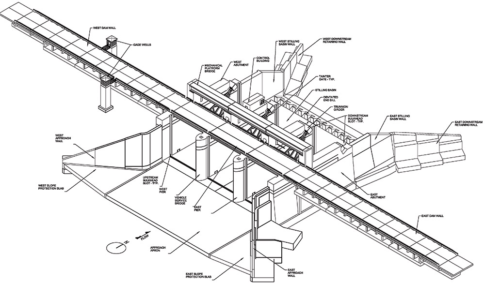
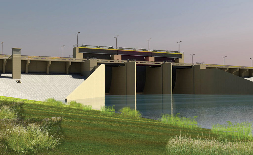
The Red River control structure, the largest of the three being constructed by the Corps, features three 50-ft-by-52-ft gates, each weighing 272,000 lb, which will be operated during floods to limit flows through the metro area. Construction of this structure includes 1.8 million cu yd of excavation, 16.5 miles of steel piling and 72,000 cu yd of concrete.
Graphics courtesy of USACE
*Click the graphics for greater detail
Stormwater Staging and Controls
Six years after breaking ground, the entire Fargo-Moorhead Area Diversion project is more than halfway complete.
The Corps’ $750-million, 22-mile Southern Embankment component and associated infrastructure includes three control structures—the Diversion Inlet, Wild Rice and Red River. A portion of the floodwaters will be stored behind the constructed embankment.
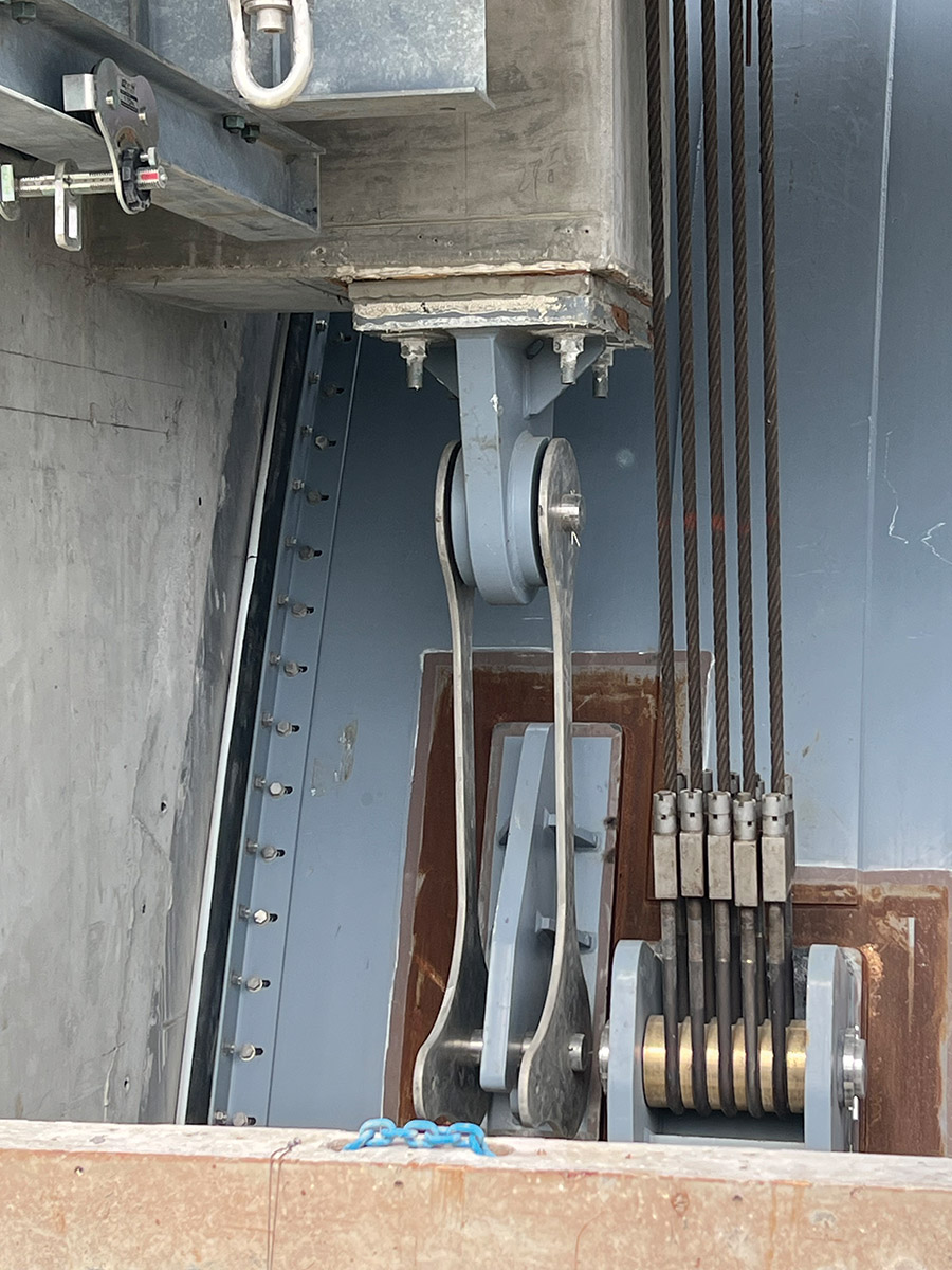
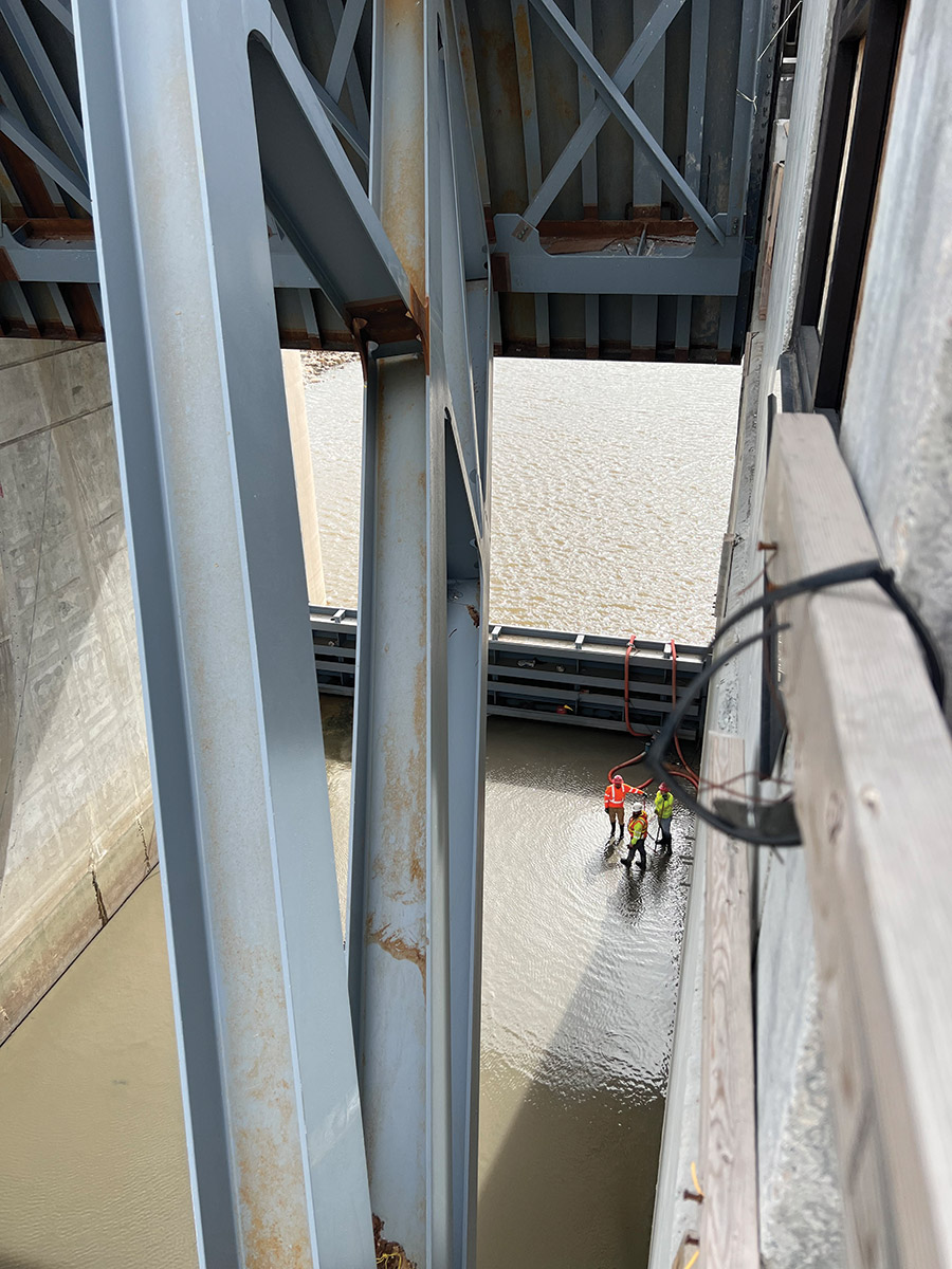
The largest control structure, Red River, has a rectangular footprint bigger than a football field. “The structure will be over 90 ft tall from the base of the 12-ft-thick structure slab to the top of the mechanical platform bridge, with about 40 ft of that height rising above the surrounding field elevation,” Williams says. Radial-arm gates—each weighing between 95,000 and 272,000 lb and measuring up to 50 ft high and 52 ft wide—will be operated remotely or manually on site during floods to limit flows through the FM metro area.
The Corps has five ongoing construction contracts with Ames Construction, Industrial Builders Inc. and H.B. Construction for this component of the project. An additional four contracts will be let in 2024.
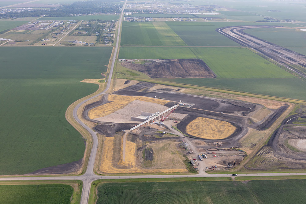
Ames broke ground in 2017 on the $45-million Diversion Inlet structure completed earlier this year. Construction on the $59-million Wild Rice River structure began in 2020 and is on track to finish in 2023. The $115-million Red River structure, the largest of the three, got underway in 2022 and is scheduled for completion in 2026.

Massive gates on the three control structures will regulate water flow through the diversion channel. Ames Construction crews broke ground on the Wild Rice River structure (above) in 2020 and are on track to complete the project by the end of this year.
Photos by Jennifer Seward for ENR
*Click on the photos for greater detail
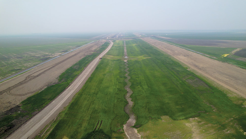
Diversion Channel
Meanwhile, the Diversion Authority/RRVA P3 is delivering the $871-million, 30-mile channel and associated infrastructure, including two aqueducts, 11 drainage inlets and a diversion outlet, all designed to keep water moving year-round to prevent ice dams from forming. Other elements include railroad, interstate and county road crossings.
RRVA and its design and construction arm, ASN Constructors—a consortium of ACCIONA, Shikun & Binui and North American Construction Group—fronts the expenses and receives payments when project milestones are met. Upon completion, RRVA will operate and maintain the diversion project for 30 years.
When the gates open on the Diversion Inlet structure at the south end of the diversion project, near Horace, N.D., stormwater will enter the 20-ft-deep and approximately 200-ft- to 300-ft-wide channel to pass safely around the metro area, ultimately reconnecting with the Red River near Georgetown, Minn., on its journey north.
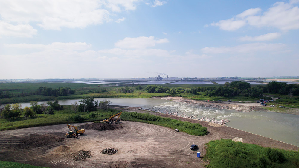
The Drayton dam was removed and a new dam constructed 300 ft upstream consisting of a rock rapids fishway. Riprap and boulders placed in a pattern create pools that allow fish to pass freely. This feature improves river health while also promoting public safety for boaters.
Photo courtesy of Metro Flood Diversion Authority
ASN broke ground on the diversion channel in 2022 and the project is on track for completion in time for the 2027 flood season.
Roughly $500 million of in-town flood protection and associated infrastructure is also being delivered across Fargo and Moorhead by city and county governments in coordination with the Corps.
There have been more than 150 projects let since 2009, says Nathan Boerboom, assistant city engineer for the City of Fargo. “These levees, floodwalls and stormwater lift stations have been utilized in recent spring floods and already provide benefit to Fargo by reducing our reliance on emergency measures, including sandbag levees,” he contends.
“We’re utilizing all three main tools in the flood protection toolbox,” the Corps’ Williams says. “Activity is going on along the entire 30-mile project. If this was being done traditionally, we would not be nearly this far along. It’s just phenomenal.”
Aqueduct structures on the Maple and Sheyenne rivers are designed to allow tributary flows to pass into the protected area in a controlled manner. ASN crews recently began driving the first of more than 48,000 linear ft of H-piles on the Maple River aqueduct.
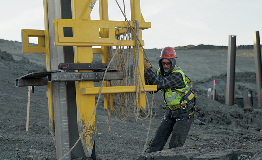
ASN crews drive 48,000+ linear ft of H-piles on the Maple River aqueduct.
Photo courtesy of Metro Flood Diversion Authority
The P3 allows for more ingenuity in the design, the Diversion Authority’s Wieser Willson says. “Our aqueducts are a key example of that. As far as we know, they are the northernmost aqueducts in the world and, because of that, the only [ones] that will have heated flumes.”
Another project innovation includes a biofuel pilot program aimed at decarbonizing infrastructure construction. ACCIONA, part of the ASN consortium, introduced the first use of renewable biofuels generated from hydrotreated vegetable waste oil to power the project’s heavy machinery. Sourced locally, “the biofuel is so far proving to be cheaper and more effective,” says Greg Yavicoli, ASN construction manager.
“There are innovations on top of innovations on this project,” says Kevin Denn, Corps project manager, noting that a unique physical model for the Red River structure was developed to ensure the project had sufficient capacity to pass the largest of floods.
“It’s the first model to use high-density foam [similar to Styrofoam] blocks instead of concrete, making it a faster, cheaper and more accurate modeling process,” he says. The model was constructed at the U.S. Army Engineer Research and Development Center in Vicksburg, Miss., during the height of the COVID-19 pandemic.
“Because travel was restricted, testing was live-streamed to allow virtual collaboration on design optimizations,” Denn says. Findings from the modeling saved the project between $500,000 and $1 million.
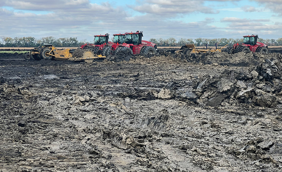
Mud is a constant headache while excavating 45 million cu yd of material on the diversion channel.
Photo by Jennifer Seward for ENR
Geological Challenges
On a visit to the channel site, while sinking into mud that has a gooey, thick consistency, Yavicoli explained how crews are working through unusual geological conditions to excavate 45 million cu yd of material—enough to fill the North Dakota Fargodome more than 47 times.
The soils atop the valley’s old glacial lake are unique to the area: the Sherack formation, stretching approximately 0-20 ft below the topsoil with an average liquid limit of 83%; and the Brenna formation, found at depths ranging from approximately 10-25+ ft below the topsoil, has an average liquid limit of 99%.
Sherack is being used to build the levee. Due to its moisture content, the Brenna is unusable and must be removed.
“We literally have to mine for material [first] to build the levee,” Yavicoli says, adding that conditions are ideal for excavating when the temperature hovers between 0 and 20° F. “People thought we were crazy to excavate through the winter, but when the sun comes out, [the excavation area] turns into a bowl of soup.”
When loaded with additional soils, such as bridge abutment backfill and roadway embankments, the water will slowly be squeezed out laterally, resulting in settlement, Yavicoli explains. Wick drains, which consist of a vertical strip of porous material, have been used in several bridge embankment locations to speed up the rate of consolidation.
Channel construction began downstream and is moving upstream in 500-yd increments with crews working 24-hours, seven days a week, including holidays. When a harsh, late winter and ensuing spring flooding earlier this year set them back two months, ASN doubled its heavy equipment fleet to 184 pieces of heavy iron, not including cranes and smaller equipment, to keep excavation on schedule, Yavicoli says.
A 30-mile diversion channel is designed to pass floodwater safely around the metro area, reconnecting with the Red River near Georgetown, Minn. This component of the project is being delivered by the Diversion Authority’s P3 partner, the Red River Valley Alliance/ASN Constructors.
Photo courtesy of Metro Flood Diversion Authority
Successful Partnership Practices
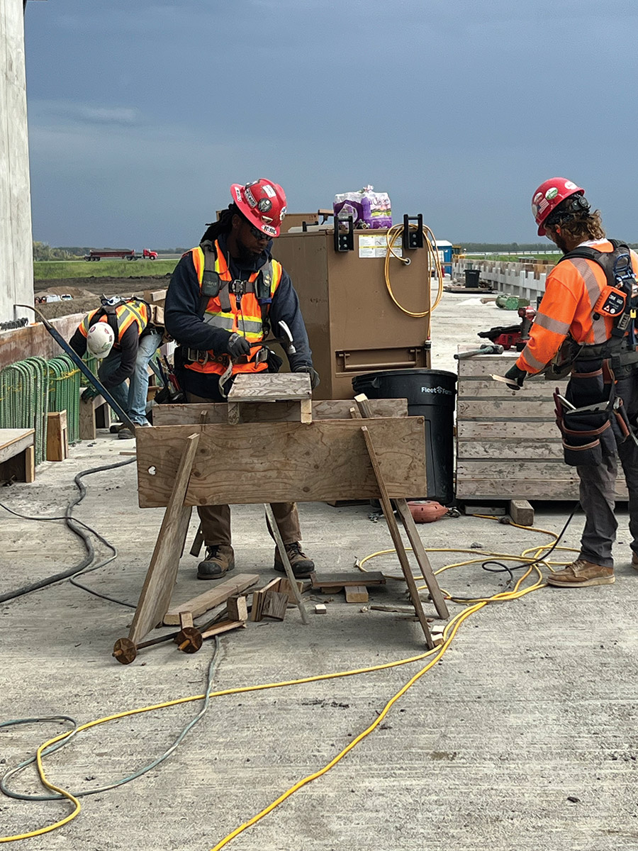
The entire diversion project has created 4,185 jobs, with a majority of them from the local community. One of the P3 requirements on the channel portion of the project includes a local workforce development plan; an apprenticeship program for multiple trades and crafts provides on-the-job skills training and weekly classes for the local workforce, Jacobs’ Barthel says.
ASN’s initial $50 million worth of equipment for the diversion channel was purchased locally as well.
The Corps and the Diversion Authority have also been partnering with local city and county entities to construct the upstream mitigation area, where floodwater will be stored and then released into the diversion channel in stages. Flowage easements are being acquired, and property and structures removed. The team is working with farmers to develop supplemental flood insurance to reimburse them if the diversion’s operation affects either their planting season or crops already in the ground, since traditional crop insurance won’t cover damage caused by the project, Barthel says.
Additionally, the Diversion Authority signed memorandums of understanding with every utility that crossed the channel and the upstream mitigation area, outlining requirements and responsibilities of the utility owners and the developer as RRVA relocated utility infrastructure impacted by the channel. “The P3 placed that schedule within the developer’s control, and that has been another success of the partnership,” Barthel says.
Eighteen utility companies have 42 miles of lines running through the area for the channel. Another 23 companies have lines impacted by the 22-mile southern embankment. Utility work is currently 70% complete.
Another best practice has been early coordination with resource agencies on any potential issues, whether that’s the Fish and Wildlife, EPA or North Dakota Game and Fish.
Mitigation projects for aquatic habitats, forests and wetlands span close to 2,000 acres, with more than half the acreage located within the diversion channel, and the team’s partners are working to minimize impacts to fish passage. Plans have been altered for the Red River and Wild Rice structures to reduce their gate operation frequency and allow fish to pass through more easily.
Williams says the project has been a once-in-a-career opportunity for everyone involved. “The project team is composed of hundreds of dedicated professionals with expertise drawn from the local area, across the nation, and even the world,” she says. “All have partnered with the citizens of the Fargo-Moorhead area to provide protection from catastrophic flooding for many generations to come.”


