Rising Challenge
Seeking New Solutions to Charleston's Age-Old Flooding Problem
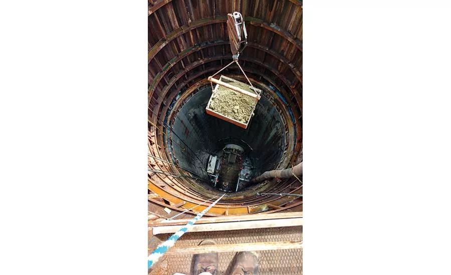
A load of excavated material is removed from a 150-ft shaft of Charleston’s Spring/ Fishburne drainage improvement project.
PHOTO STEVE KIRK, CITY OF CHARLESTON
 Flooding from rising sea levels is nothing new to South Carolina’s largest city. In the 1830s, the mayor offered a $100 gold medal to anyone who could come up with a solution. No one ever did.
Even if solutions were put in place then, chances are new solutions still would be needed. Harbor gauge data indicates the sea level at Charleston has risen more than a foot since 1920. Flooding from king tides also has become more frequent and could occur at an average of 180 days each year by 2045.
MID-ATLANTIC NOAA forecasts predict that Duck Pier, N.C., will face between 2.2 ft and 6.77 ft of sea-level rise by 2100.
In 2016, Charleston’s City Council enacted a multifaceted Sea Level Rise Strategy, designed around an expected 1.5- to 2-ft rise over the next 50 years. The plan includes a number of drainage improvements, the largest of which to date is a five-phase, $154-million program to improve a particularly flood-prone 500-acre drainage basin by 2020. Work is currently underway to install a system of 12-ft-dia tunnels 140 ft underground; that job will be followed by the addition of a pumping station and discharge piping to a nearby river.
Charleston also is exploring the feasibility of repairing its deteriorating, century-old “Low Battery” Seawall, a one-mile concrete wall constructed on a timber deck and supported by timber pilings to protect the city’s southernmost section. Although the project is still in initial scoping and design, rebuilding the structure to account for an anticipated sea-level rise of 2.5 ft could cost as much as $100 million and require a decade of construction. No funding source for the project has been identified.

