Disaster Response
Florida Braces as Hurricane Ian Slams Ashore
Storm surges could peak at 18 ft. amid 155-mph wind gusts
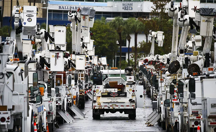
Duke Energy trucks are staged the parking lot at Tropicana Field in preparation for Hurricane Ian on Wednesday, Sept. 28, 2022 in St. Petersburg, Fla. Hurricane Ian rapidly intensified as it neared landfall along Florida's southwest coast Wednesday morning.
Photo by Dirk Shadd/Tampa Bay Times via AP
Florida is bracing for major impacts from Hurricane Ian, a Category 4 storm that brought flooding storm surges and winds of up to 155 mph as it made landfall Sept. 28 in the southwest portion of the state. The slow-moving storm—which is expected to reach northern Florida and southern Georgia early on Sept. 30, according to the National Hurricane Center—is bringing threats of flooding across Florida to as far away as North Carolina.
As of 11 a.m. Sept. 28, the National Weather Service forecast a “catastrophic storm surge of 12-18 ft above ground level with destructive waves along the southwest Florida coastline from Englewood to Bonita Beach,” urging anyone in that area to follow evacuation orders.
Wind damage also is forecast to be catastrophic along the southwestern coast on Sept. 28 as heavy rainfall was expected to spread across the Florida peninsula through the next day, with widespread, life-threatening flooding across portions of southwest and central Florida and considerable flooding elsewhere.
On its way to Florida, Ian knocked out power across all of Cuba, according to the Associated Press, as the storm reformed around a new eye overnight on Sept. 27, gathering strength to just short of Category 5 strength.
As the storm progressed Sept. 28, videos flooded social media of rising storm surges in Fort Myers and other parts of southwest Florida as Ian lingered along the coast through much of the day.
By 3 p.m. local time, Duke Energy was reporting more than 77,000 customers without power through central Florida, with the majority, around 73,000, in the Tampa Bay area. Florida Power & Light, the utility for most of South Florida, reported hundreds of thousands without power in areas around Fort Myers in Lee and Collier counties at the same time.
Contractors located on Florida's Gulf coast scrambled as Ian's path changed from a projected Panhandle landfall to one further south in the Fort Myers-Sarasota area.
“Up and down the Gulf Coast, contractors have been preparing, cleaning up and securing job sites,” says Steve Cona, president and CEO of the Florida Gulf Coast chapter of Associated Builders and Contractors. “They are also taking steps to document the current state of projects in preparation for damage that could occur from the hurricane.”
Cona says the biggest concern for construction sites are wind and water damage, and while many projects have weather days as part of their schedules, a severe storm could create additional delays.
"Recovery will be the next phase of the operation,” he says. “ABC will work with our government agencies to ensure we create a streamlined regulatory environment to fasttrack rebuilds, repairs and supply chain.”
The U.S. Army Corps of Engineers readied for the storm by inspecting the entirety of the 143-mile Herbert Hoover Dike around Lake Okeechobee, says Jim Yocum, a local spokesman. The Corps has virtually completed extensive rehabilitation of the dike over the past 15 years, he says, with $1.6 billion in work now 99.9% complete.
“The dike is probably in the best shape it’s ever been in before a storm,” Yocum says. With a drier-than-normal rainy season, the level of the lake is about 2 ft lower than last year, he says, leaving more room to catch water from the storm.
“We can’t promise anything, but it looks promising that we won’t need to release large amounts of water once the storm is over,” he says.
The Corps has Emergency Operations Centers established in Tallahassee and Jacksonville, Yocum says, with engineers and temporary power restoration teams across the state ready to respond once FEMA issues the its "mission assignments." He says 116 Corps employees and 303 contractors have been deployed.
Yocum says the Corps is not too concerned about its construction sites such as beach renourishment projects designed to establish beaches specifically to take the brunt of storm impacts like those brought by Ian.
“Their whole purpose is to protect the actual infrastructure,” he says. “We expect to see a lot of erosion on project sites, but we believe without them there, we would see more damage to buildings, roads and other facilities.”
The storm is forecast to move through Florida on Sept. 29, reaching the Georgia coast the morning of Sept. 30 and moving into South Carolina that night.
According to the National Hurricane Center, storm surges could peak in southwestern Florida at 12-18 ft., and in Georgia and South Carolina at between 3-6 ft., with rainfall totals forecast to reach up to 20 in. northeast of Orlando, and bands of rain of as much as 6 in. as far north as western North Carolina.


