South Carolina Untangles Its ‘Malfunction Junction’

The $2.1-billion Carolina Crossroads project aims to increase safety and decrease congestion on one of the state’s principal interstate choke points.
Photo courtesy SCDOT/CDM Smith
The South Carolina Dept. of Transportation is untangling a congested, complicated knot of an interstate corridor, aiming to change the so-called “malfunction junction” into the safe, modern and smooth-traveling Carolina Crossroads. The ambitious, $2.1-billion project is the largest the state has ever undertaken—as it overhauls the corridor of Interstates 20, 26 and 126 in Columbia in a redesign to prioritize safety and traffic flow on the most congested portion of highway in South Carolina’s Midlands region.
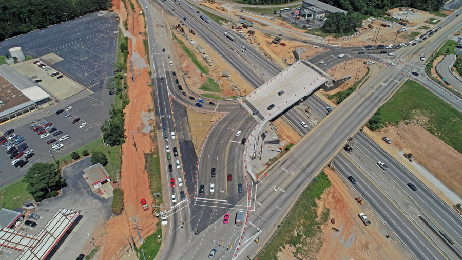
Added capacity and redesigned interchanges are expected to cut the annual average of 112 hours of sitting in traffic for the 134,000 motorists who travel the 14-mile corridor daily.
Photo courtesy SCDOT/CDM Smith
According to the state DOT, the corridor now handles more than 134,000 vehicles daily. The difficulty of making traffic maneuvers over short distances, including crossing three lanes of interstate in a half-mile to make one connection, leads to an annual average of 112 hours stuck in traffic for those drivers.
The corridor is the crossroads of the South Carolina economy, DOT officials say, serving as a major route for cargo between Lowcountry ports and Upstate manufacturers. It’s also a key hub for area commuters and out-of-town travelers heading to the mountains or the coast.
Crews are replacing the cloverleaf loops with more modern interchange styles, including plans for the state’s first turbine-style interchange at I-26 and I-20. Traffic lanes are being added to I-26 to bring the minimum mainline lanes to four across the eight miles of I-26 in the project area, and exits will be lengthened and widened for capacity. These changes will accommodate traffic brought by a forecasted 70% increase in population in the Midlands by 2040.
A joint venture of Archer Western and United Infrastructure Group is constructing the first two phases, totaling about $350 million. Work began in 2022 with Phase 1, which includes improvements to I-126 at Colonial Life Boulevard and I-20 between Bush River Road, near the I-20/26 intersection, and US 378 to the south of the Saluda River. Phase 1 is slated for completion late this year.
Work on Phase 2 began in fall 2022 along I-20 and at its intersection at Broad River Road, and includes three new bridges: two for a diverging diamond interchange over I-20 and one for a collector ramp, all to be completed in early 2025.
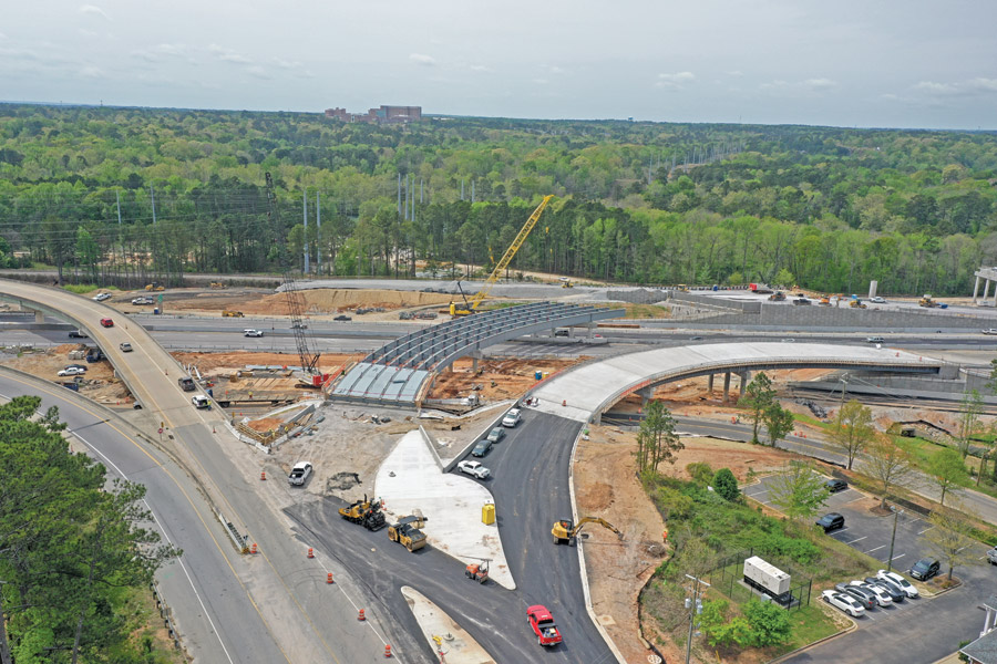
The project includes more than 40 new bridges, widening 14 miles of interstate, two new interstate-to-interstate interchanges and five service road interchanges.
Photo courtesy SCDOT/CDM Smith
HDR is providing project management services to the state DOT for the project, including Phase 3, the largest package. It is broken into five smaller subphases, starting with 3A, utility and frontage road relocation around the I-20/I-26 intersection. Phase 3B entails clearing and grubbing work in the same area, and the scope of Phase 3C includes an accelerated widening of I-20 to the south of the I-20/26 intersection with bridges over the Saluda River and CSX railway.
Phase 3D includes improvements to the I-26/I-126 connection between Phase 1 and the I-20/I-26 interchange, and Phase 3E encompasses the improvements to that interchange itself, including the planned replacement of the four-loop cloverleaf with the state’s first turbine interchange.
Phases 4 and 5 have been combined into one, covering the widening of I-26 west of the I-20/I-26 interchange. All phases are set for a 2029 completion.
Rett Triplett, United Infrastructure Group vice president and operations officer for the joint venture, says work is ongoing for bridge decks on Phase 1, set to complete in mid-September.
“These are two complex construction projects in a major South Carolina metro area,” he says, making traffic management a major challenge.
“That’s been a major focus of ours over the years, to make sure we do these significant improvements without making things tremendously worse while we’re doing the project .”
—Brian Klauk, Carolina Crossroads Project Director, South Carolina DOT
Both phases include three bridges. In Phase 1, the 3,400-ft-long Bridge 35 has given the team issues due to more rock than anticipated in its drilled shafts, especially close to the river. Part of the bridge is also in the railroad right-of-way or within its 50-ft offset, requiring the team to upsize its cranes. Tim Marsh, United Infrastructure Group senior project manager, says cranes used were a 275 ton, a 250 ton and a 200 ton. Take out the railroad and the team could have used two 200-ton cranes, he adds.
The bridge crosses the Saluda River and the railroad, he says, with 34 total spans, with three steel girders over the railroad, a steel straddle bent over the railroad and 31 concrete girder spans.
Bridge 36, also on Phase 1, is proving to be the most difficult, Triplett says. It is a 650-ft-long, curved steel girder bridge that requires close coordination to walk singular curved girders onto the highway and secure the 150-ft to 180-ft sections. That work, which required detours and traffic slowdowns on I-26, is likely the biggest structural challenge, he says, though the team also encountered unexpected subsurface rock conditions in various areas of the project, requiring flexibility on multiple walls along the project area.
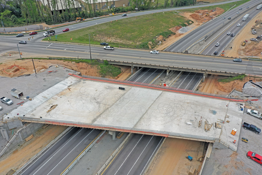
Design-build has allowed contractors the flexibility to improve the project by changing interchange types and rehabilitating two existing bridges rather than constructing new ones.
Photo courtesy SCDOT/CDM Smith
Phasing Out Risk
The biggest change for the project has been the rephasing of Phase 3, initially a $1.1-billion plan. It became apparent that risks in underground utility locations left it too exposed for potentially large change orders, says Brian Klauk, Carolina Crossroads project director for the state DOT. Agency leadership canceled its procurement in October 2023 and broke Phase 3 into five smaller phases to reduce those risks.
Ben Lewis, HDR project manager, says the firm in February began supporting the reconfiguring of Phase 3, working “from the outside in” to break it into bite-size pieces and mitigate risks.
The rephasing plan breaks off utility work—and risk—into a stand-alone project. It breaks remaining work into smaller, more manageable pieces, opening opportunities for more design-build contracts.
“It’s a challenge of constantly monitoring those risks and anticipating changes applicable to each of those risks,” Lewis says. “And then, tied to each of those risks is obviously cost and schedule impacts, because time equals money.”
The market has been fluctuating in material availability and labor force issues, especially since the COVID-19 pandemic, he adds.
“Today, our biggest challenge I would say is cost and schedule control,” Lewis says. HDR uses a cost schedule risk analysis, bringing together team members and subject matter experts to talk about base cost estimates and schedule, finding probabilities of risks and their potential cost and schedule impacts.
“This is a three-day workshop we’ve conducted for the past four years, which has allowed us to control the cost as much as we can,” he says. “It’s been quite effective.”
Design-build has been key to the project, says Klauk, allowing "industry to build a better mousetrap for us, and show us how to use ... creativity to take advantage of some efficiencies,” he adds. “We’ve seen some great ideas ... be implemented in construction.”
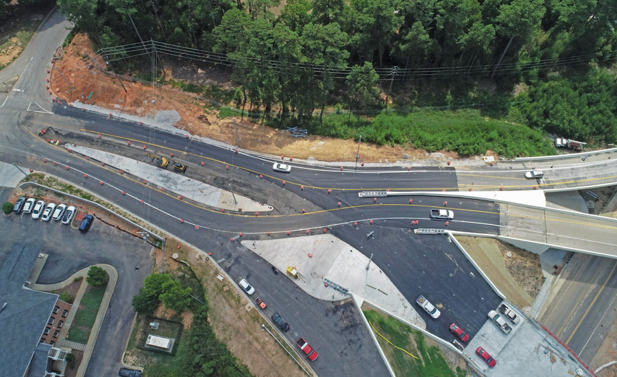
Modernizing interchanges is a goal of the project, including multiple diverging diamond interchanges and one planned turbine interchange to replace more traditional cloverleaf loops.
Photo courtesy SCDOT/CDM Smith
Some examples of that include rehabilitating two curved steel bridges instead of replacing them, saving money and extending service lives of the two critical structures, he says. In Phase 2 the team changed the interchange type to an offset diverging diamond, saving [maintenance of traffic] stages in bridge construction and providing a more efficient, resilient design in terms of traffic flow and congestion relief.
For Phase 3A, the DOT opted for traditional bid-build, he says, allowing it to work directly with utility stakeholders to ensure there were no conflicts with construction and to reduce risk associated with geotechnical conditions and utility placements.
“One of the main thrusts of this project is to reduce that risk, reduce the exposure of the agency and get a project that’s a better price for the taxpayers but keeping the same value,” Klauk says.
Seeking maximum value has influenced the current interchange designs on the project, including one turbine and multiple diverging diamonds. With the turbine interchange in Phase 3, the goal is to connect Interstates 20 and 26 without the mainline weaving movements required by the existing four-loop cloverleaf interchange. Turbine interchanges typically feature right-exit, left-turning ramps that sweep around the center of the interchange in a clockwise spiral. However, Klauk says the state is open to other design alternatives once the project reaches that point.
“We studied quite a few other interchange [options] through the NEPA phase and we’re open to those, and open to performance … that gives us better traffic congestion relief and better safety performance,” he says. If constructed, it would be South Carolina’s first turbine interchange. Phases 1 and 2 both feature diverging diamond interchanges.
Finding sufficient labor has been the main challenge for the project, says Marsh, prompting the joint venture to hire three craft and trade recruiters.
“The labor shortage has been the biggest issue for both phases,” Marsh says. “Even at this point with less than a year remaining on these projects, we are 15-20 craft workers short of being fully staffed.”
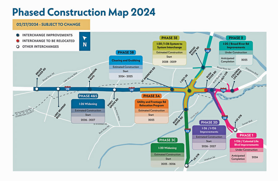
Phase 3, representing roughly half the project’s $2.1-billion cost, was broken up into five smaller subphases to better manage risk and other project challenges.
Image courtesy SCDOT
Rocky Road Remix
“One of our main goals is to do this very large construction project with minimal disruption to traffic and freight movement through the corridor,” says Klauk. “That’s been a major focus of ours over the years, to make sure we do these significant improvements without making things tremendously worse while we’re doing the project.”
So far crews have been successful in phasing the project for flexibility and to make room for unknowns, like unexpected subsurface rock and procurement issues that he marks as the top two challenges.
“It’s a challenge of constantly monitoring those risks and anticipating changes applicable to each of those risks.”
—Ben Lewis, Project Manager, HDR
The project is situated mostly in the Piedmont physiographic province at the South Carolina fall line zone, with rock in the area belonging to the Carolina terrane. Due to proximity to the fall line, weathering of bedrock is variable and depth to sound rock varies.
“We’ve done a lot of geotech work, very extensive geotech exploration, but you can’t ever catch everything,” Klauk says. “The way we phase this program helps us to do some additional advanced work and coordination with our utility partners to make sure everybody’s got a good place to go during the construction and relocation, and to make sure that if there’s any rock that’s going to be in the way, we’ve got a good way to handle that.”
That’s led to some utilities being rerouted or extra work hammering rock, but it has not pushed the substantial completion date forward any, Klauk says. The state DOT is closely coordinating with about one dozen utility firms to navigate utilities through the network of urban development and suburban infill. Work includes relocation of about 60 miles of telecommunications line, from 1.25 in. to 4.25 in-dia., more than two miles of 2-in. to 8-in. gas distribution line and more than two miles of wet utilities with varying diameters, including greater than 36 in.
Right-of-way acquisition has been completed through Phase 3 and is nearly complete for Phases 4 and 5, he adds. Phase 3C is the next design-build project, which advertised an RFQ in May. The winning team will be announced in April 2025.
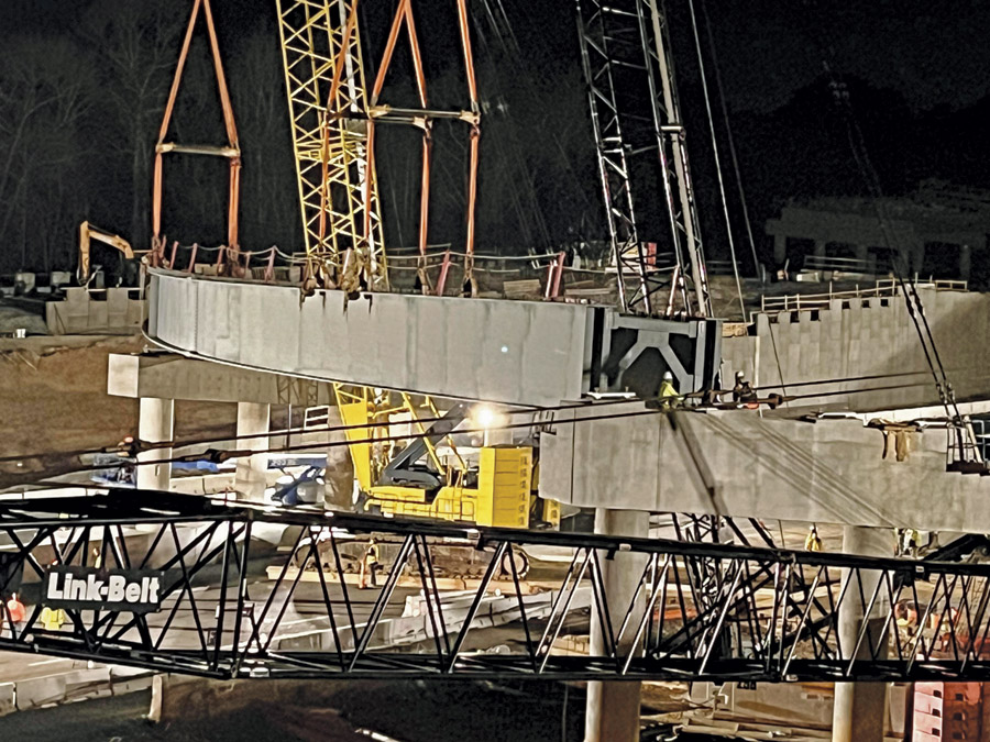
Safety and avoiding impacts to already congested traffic in the area are major elements of ongoing work.
Photo courtesy SCDOT/CDM Smith
Mitigating Impacts, Past and Future
Each phase includes a river located inside project limits as well as other environmentally sensitive areas, Marsh notes. In Phase 1, crews are dealing with a crossing of the trout-filled waters of the Saluda River, a state-designated scenic river, and a flood control dam a few miles upstream. The project team works closely with the operators of the dam for regular updates regarding when higher than normal flows will reach the project site. The historic Saluda River Canal, constructed in the early 1800s to navigate commercial traffic around rapids on the river, must be protected.
Fortunately, Klauk says the canal did not require right-of-way acquisition, but the team had to design around it by establishing flagging lines and fencing to make sure no equipment inadvertently encroached on it. Any vibrating equipment is located far enough away to prevent it doing damage to existing man-made features such as stacked rock. Mitigating those impacts led the project team to find a work-around.
To secure its federal Clean Water Act Section 404 permit from the U.S. Army Corps of Engineers, the DOT purchased two large tracts of land—preserving wetlands and streams on one and restoring and preserving a stream on the other to completely offset project impacts, Klauk says.
“We’ve completed that and are doing our five-year monitoring right now,” he explains. “We’re close to being able to turn that over to the [South Carolina Dept. of Natural Resources], and that will become public land, to be managed "in perpetuity.”
Securing that 404 permit usually requires final design, Lewis explains. But with a project this size, that was not an option. The intent was a multiphase, design-build approach, so HDR and the state DOT worked with the Corps to formulate a plan for preliminary design for the entire program and set limits to certain wetland impacts. Conditionally, the Corps then required the agency to create the "permittee responsible mitigation site."
When each of the design-build phases completes, the permit will be modified to reflect actual wetland impacts.


