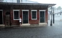
Preliminary data sampling from a prototype system that blends observations, weather forecasts and combined water models with decision support tools to predict storm flood heights in coastal areas shows that, during the passage of Hurricane Irene, the system made highly accurate predictions in the sampled locations.
“Irene is the first really large and intense event we’ve tried to predict,” says Suzanne Van Cooten, research hydrometeorologist with the National Oceanic Atmospheric Administration. “From looking at what we’ve reviewed so far in the tidal-plane area, our predictions were within half a foot. We were right on for the total water inundation levels.”
The Coastal and Inland Flooding Observation and Warning (CI-FLOW) Project connects river models to coastal ocean models to account for all the water that’s in a coastal floodplain basin. Until now, total water-level forecasts have never been done for coastal areas, says Van Cooten.
The CI-FLOW project is led from the National Severe Storms Lab out of the National Sea Grants office. Academic institutions and the U.S. Geological Survey are partnered in the project to gather the information needed for accurate prediction. They are placing water-level gauges in key locations to constantly capture water-level data, every day, routinely, as well as to record flood heights in storm situations.
The team already predicts inland flooding by measuring the total water levels in inland areas. But predicting total water levels for coastal regions brings in many more variables. The team must compute not only rainfall and quantitative precipitation forecasts but levels of tides, surges and waves as well.
“The project is an attempt to use the latest computer models to forecast severe storms like this one,” says Rick Luettich, director of the Center for the Study of Natural Hazards and Disasters at the University of North Carolina, Chapel Hill. Luettich's models were used extensively in the CI-FLOW project.
The advanced coastal-phenomena prediction models that Luettich helped develop are also being used by the U.S. Army Corp of Engineers to develop protection system designs for flood-prone areas, such as southern Louisiana. “FEMA is also using them to predict 100-year flood levels,” Luettich adds.
Luettich directs a center of excellence at UNC, funded by the Dept. of Homeland Security, whose purpose is to take the modeling systems and coordinate with civil engineers to study flood implications for civil infrastructure. His live coastal models can be viewed at http://nc-cera.renci.org/.
The results of this CI-FLOW trial will be used to validate the project as well as develop it for making predictions that are available to the public and better inform civil engineers about probable structural damage from predicted flooding.


Post a comment to this article
Report Abusive Comment