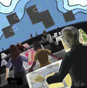
Artwork by Eddy Rojas
The ground began to shake. We knew it must have been a big one. Our building’s design would withstand the quake’s tremors with ease, and our regenerative control systems were going to make us fully operational within a few minutes. The large ultra-high-resolution visualization wall at the front of the room displayed a map of the city. Every structure within the city limits appeared on the map as well as the location of all emergency response assets. In a flash, we knew where we stood.
“Mr. Li,” I said, turning to the new president of our city council with more than a share of disbelief. “You picked a heck of a day for a tour of our new Emergency Operations Center.”
“Yes, Director Roberts,” he replied, his face blanched. “Please put formalities aside. Call me Feng.”
“Sure,” I replied, appreciating the frankness of the city’s newest leader. “And you can call me Susan.”
The room buzzed with activity. Verifications of system conditions flashed across the wall display. One-by-one, green lights appeared on our dashboard. We were clear to go.
“Lisa,” I called over the hum, “give us a status report, please.”
 “Well,” she replied, with clear hesitation on her voice, “it looks like this is an eight-point-five on the Richter scale. Only 20 miles deep. The epicenter’s 100 miles from the coast. We’re beginning to get telemetry, including satellite imagery. The drones went out according to plan—since the intensity’s above six-point-five. Information should be coming any time now.” Lisa turned from her desk’s dashboard to look at me. Her brow furrowed. “Given the circumstances, we should expect significant damage as well as injuries and fatalities. Our city has a population of 10 million, after all.”
Feng became agitated. “I must call my family. I must check that they’re OK.”
“Sorry Feng,” I replied, not taking my eyes off the visualization wall. “But we block all calls in and out of the building during emergency situations. We must focus on managing the emergency. We’ve all got families out there. Try to remain focused on the big picture.” I looked at him. “The best way to help our families is to do the best job we can as emergency managers.”
He gritted his jaw, but nodded. “Okay. Tell me what I’m looking at,” he said, moving closer to the display.
I moved to my display so I could bring up the significant information on the wall. “As you know, for the past twenty years, city codes have required the installation of advanced sensory arrays in all new structures and infrastructure systems. For those structures, we have all the information we need to make well-informed decisions.” I selected a building to bring up the corresponding data about its current systems. “Unfortunately, only 25% of our inventory has been built since those codes went into effect. We’ve been working on retrofitting the legacy structures with basic sensors, but we’ve completed less than ten percent of the work so far. We do not have the authority to compel private owners to retrofit their structures. So, we don’t have direct information for about 70% of our structures. We rely on satellite and drone imagery to offset the gaps, as well as virtual sensors and simulation models. That’s how we make assessments. We do our best, but the accuracy is not the same without direct information.”
Feng began to look impatient. “What about a tsunami?”
Pedro, our Coast Guard liaison, spoke up. “I’ll bring up the costal models on the dashboard.” The visualization wall revealed a map of the coast, much in deep blue with flashing indicators, but regions dimmed in gray.
“Why do you have some much gray?” Feng asked.
“Well,” replied Pedro, “some of our DART buoys are not reporting data. They’ve been malfunctioning. But with the budget cuts, you know—”
Lisa took over the dashboard again to show the city map. Colors flashed as data became information. Green, yellow, orange, red, purple. The colors slowly filled in the gray. Not surprisingly, we all saw the legacy—mostly historical structures—had suffered the most damage. Some newer ones had also been significantly affected.
Roger, our liaison with the city department of transportation, came forward. “Director Roberts, could we focus our attention on the transportation network for a second?” When I nodded, Roger brought up his workstation’s information on the wall and superimposed the status of the city roads and bridges on the map. “As you can see, we’ve got several issues. A couple of bridges have failed and a few overpasses are not structurally sound. We’re also facing debris in the roads. Unfortunately, we don’t have precise information on several structures.” His fingers flashed across his workstation as he rotated through images of the city’s roads. “I propose we implement emergency measures and overwrite reference maps to assume damage in those areas with incomplete information.”
“Agreed, Roger,” I replied.
“What are reference maps?” Feng asked.
“They’re the maps autonomous vehicles use when plotting a route from point A to point B. By overwriting the maps, we are ‘virtually deleting’ those roads,” I said, “so autonomous vehicles won’t take them.”
“Furthermore,” I added, “we also ‘delete’ routes that we want to make available exclusively to emergency vehicles or private vehicles transporting the injured.”
After reflecting for a few moments, Feng challenged, “But wouldn’t closing or ‘deleting’ roads just because you do not have complete data put the public at risk by reducing the transportation network?”
“Yes,” I replied without hesitation. “But what if those roads are severely damaged and we lose more lives because we did not act? It’s not an easy call, but we must make decisions with the information we have. Autonomous vehicles cannot easily maneuver around roads that have been damaged by earthquakes or have significant amounts of debris.”
About half an hour had passed since the earthquake. With enough information at our fingertips, I turned to my team. “It’s time to deploy the RRTs according to our priority protocols.”
Feng looked bewildered. “RRTs? Priority protocols?”
“RRTs are Rapid Response Teams that we mobilize to initiate rescue operations. We synthesize the information we have with the predictive models that estimate the most affected areas and send our RRTs there.”
“Why don’t we just send RRTs all over the city?” Feng asked.
“We just do not have enough units to do so,” I replied, “We’re also contacting neighboring cities to request some of their RRTs. But, it will be hours before they arrive, and we must decide where to deploy our limited resources right now to maximize our effectiveness.”
We watched as the RRT’s appeared on our screen. As we saw one location’s problems neutralized, we moved onto the next. Everything went according to plan.
After about an hour, I smiled and clapped my hands.
“OK. That’s enough. Thank you everybody. The simulation is over!”
All personnel began applauding and laughing. A sense of relief took over the command center as colleagues began high fiving and hugging each other.
“This was by far the most realistic simulation we have executed so far,” I called over the commotion. “Your performance has been simply outstanding.”
In the corner, Feng collapsed into a chair. His face went through all the colors of the rainbow. “A simulation?” he asked. “Are you telling me that all of this has been make believe?”
“Yes,” I replied, “but I could not tell you since your reaction would have affected the behavior of our personnel. I was the only one aware of the fact that this was a simulation. From their perspective, it was real. I needed your reactions to be genuine. I’m sorry to have scared you.”
Feng rested for a few minutes, layers of tension falling away from his face. Then, standing up, he said, “OK! I need to go and be with my family.”
“Wait a second,” I replied, opening a file on my tablet. “I have a document for you.” I beamed the document to his handheld. “Over the years, we’ve unsuccessfully petitioned city council for funds. I have compiled some proposals for your consideration and would greatly appreciate it if you take the time to review and present them to the council.”
Feng looked at the list of requests—for ordinances compelling owners of legacy structures to retrofit with basic sensory arrays, for funds to replace malfunctioning DART buoys, for broader sensory networks and information systems in the city’s roads and bridges, for more RRT units. Then he looked at me with intensity and purpose, as if he would eat me with his eyes. “I’ll give it to you, Susan. We’ll find the funding somehow.”
With a laugh, he added, “You definitely know how to make your point.”

Eddy Rojas is Director of the Durham School of Architectural Engineering and Construction at the University of Nebraska-Lincoln, where he oversees academic programs in architectural engineering, construction engineering and construction management. Dr. Rojas holds advanced degrees in civil engineering and economics and is a registered Professional Engineer in Michigan. Throughout his academic career, he has led numerous research studies in modeling, simulation and visualization of construction engineering and management processes, construction economics and engineering education. Results of his research have been documented and disseminated in more than 85 publications.
To see all of the Construction Science Fiction stories, click here.


Post a comment to this article
Report Abusive Comment